Category:Maps of provinces of Viceroyalty of New Granada
Jump to navigation
Jump to search
Subcategories
This category has only the following subcategory.
Media in category "Maps of provinces of Viceroyalty of New Granada"
The following 26 files are in this category, out of 26 total.
-
 Antioquia (1760).svg 1,742 × 1,987; 589 KB
-
 Antioquia (1800).svg 1,742 × 1,987; 651 KB
-
 Antioquia (1814).svg 2,012 × 2,379; 985 KB
-
-
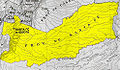
 Map of La Guajira 1769.png 600 × 401; 1.01 MB
-
 Mapa de la Gobernación de Guayaquil 1.III.1804 - AHG.jpg 3,367 × 2,224; 2.24 MB
-
 Mapa de la Provincia de Antioquia (1775).jpg 1,552 × 2,110; 565 KB
-
 Mapa de la Provincia de Antioquia (1809).jpg 602 × 1,046; 395 KB
-
 Mapa de la Provincia de Cartagena (1787).jpg 3,455 × 5,355; 3.06 MB
-
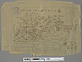 Mapa De La Provincia Y Missiones De La Compañi IHS del Nuevo Reyno de Granada.jpg 5,766 × 4,395; 4.55 MB
-
 Mapa de Santander (1810).svg 940 × 1,258; 292 KB
-
 ProvinciaAntioquia.jpg 466 × 529; 176 KB
-
 ProvinciaBogota.jpg 991 × 577; 288 KB
-
 ProvinciaCartagena.jpg 607 × 553; 178 KB
-
 ProvinciaCasanare.jpg 564 × 413; 155 KB
-
 ProvinciaChoco.jpg 305 × 657; 125 KB
-
 ProvinciaIstmo.jpg 480 × 382; 64 KB
-
 ProvinciaMariquita.jpg 276 × 305; 83 KB
-
 ProvinciaNeiva.jpg 320 × 393; 101 KB
-
 ProvinciaPamplona.jpg 198 × 269; 64 KB
-
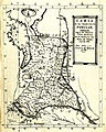
 ProvinciaPopayan.jpg 1,810 × 1,353; 864 KB
-
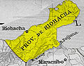 ProvinciaRiohacha.jpg 363 × 284; 75 KB
-
 ProvinciaSantaMarta.jpg 411 × 524; 133 KB
-
 ProvinciaSocorro.jpg 263 × 322; 89 KB
-
 ProvinciaTunja.jpg 342 × 299; 93 KB
-
 ProvinciaVeragua.jpg 512 × 348; 60 KB
.svg)
.svg)
.svg)
_-_AHG.jpg)


.jpg)
.jpg)
.jpg)

.svg)


