Category:Maps of provinces of Equatorial Guinea
Jump to navigation
Jump to search
Subcategories
This category has the following 9 subcategories, out of 9 total.
!
A
B
- Maps of Bioko Norte (4 F)
- Maps of Bioko Sur (4 F)
C
- Maps of Centro Sur (4 F)
D
- Maps of Djibloho (1 F)
K
- Maps of Kié-Ntem (4 F)
L
- Maps of Litoral (4 F)
W
- Maps of Wele-Nzas (5 F)
Media in category "Maps of provinces of Equatorial Guinea"
The following 12 files are in this category, out of 12 total.
-
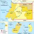
Aequatorialguinea-karte-politisch.png 624 × 624; 131 KB
-
Equatorial Guinea provinces blank.png 2,000 × 1,175; 17 KB
-
Equatorial Guinea provinces named.png 750 × 441; 21 KB
-
Equatorial Guinea provinces numbered.png 300 × 176; 6 KB
-
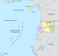
Equatorial Guinea, administrative divisions - de - colored 2020.svg 1,091 × 1,042; 194 KB
-
Equatorial Guinea, administrative divisions - es - colored 2020.svg 1,091 × 1,042; 229 KB
-
Equatorial Guinea, administrative divisions - th - colored 2020.svg 1,091 × 1,042; 350 KB
-
Mapa Gwinei Równikowej prowincje numerowana.gif 831 × 487; 13 KB
-
Political map of Guinea-es.svg 417 × 435; 331 KB
-
Provinciae Guineae Aequinoctialis Latine.png 555 × 313; 45 KB
-
Provincii Ekvatorial'noj Gvinei.PNG 624 × 624; 77 KB
-
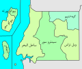
محافظات غينيا الاستوائية.svg 300 × 250; 43 KB


