Category:Maps of protected areas in Maine-et-Loire
Jump to navigation
Jump to search
Media in category "Maps of protected areas in Maine-et-Loire"
The following 5 files are in this category, out of 5 total.
-
Périmètre RNR Basses-Brosses et Chevalleries rnr259.png 1,298 × 856; 479 KB
-
Périmètre RNR Champagne de Méron rnr337.png 1,000 × 849; 484 KB
-
Périmètre RNR Coteaux du Pont Barré rnr58.png 1,298 × 818; 467 KB
-
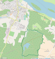
Périmètre RNR Etang et boisements de Joreau rnr297.png 799 × 857; 347 KB
-
Périmètre RNR Ferme de la Chauffetière rnr193.png 998 × 815; 203 KB


