Category:Maps of protected areas in Isère
Jump to navigation
Jump to search
Media in category "Maps of protected areas in Isère"
The following 13 files are in this category, out of 13 total.
-
 Bois de La Bâtie automne 2017 02.jpg 2,136 × 1,892; 2.4 MB
-
 Chamrousse UT4M abc23.jpg 2,288 × 1,712; 765 KB
-
 Marais des Seiglières mai 2018 abc3.jpg 2,560 × 1,920; 1.54 MB
-
 Périmètre PNR de la Chartreuse.png 1,000 × 1,050; 1.05 MB
-
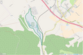 Périmètre RNN Etang du Grand-Lemps rnn115.png 1,236 × 824; 338 KB
-
 Périmètre RNN Haute vallée du Béranger rnn14.png 1,239 × 828; 432 KB
-
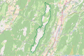
 Périmètre RNN Haute vallée du Vénéon rnn13.png 1,238 × 826; 262 KB
-
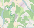
 Périmètre RNN Hauts de Chartreuse rnn136.png 1,234 × 823; 829 KB
-
 Périmètre RNN Hauts plateaux du Vercors rnn74.png 1,116 × 1,424; 1.09 MB
-
 Périmètre RNR Etang de Haute-Jarrie rnr74.png 1,296 × 818; 401 KB
-
 Périmètre RNR Etang de Saint-Bonnet rnr76.png 1,296 × 819; 966 KB
-
 Périmètre RNR Etangs de Mépieu rnr159.png 996 × 818; 395 KB
-
 Périmètre RNR Isles du Drac rnr201.png 960 × 885; 805 KB


