Category:Maps of proposed countries in South America
Jump to navigation
Jump to search
Subcategories
This category has only the following subcategory.
P
Media in category "Maps of proposed countries in South America"
The following 7 files are in this category, out of 7 total.
-
Federación de los Andes.png 1,816 × 1,620; 219 KB
-
Federación de los Andes.svg 2,232 × 3,260; 9.92 MB
-
Federation of the Andes (orthographic projection).png 1,280 × 1,280; 434 KB
-
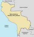
Mapa Reino Unido Ecuador Perú y Bolivia.png 1,509 × 1,600; 171 KB
-
Nueva Gran Colombia.svg 439 × 294; 164 KB
-
Patria Grande.png 460 × 449; 5 KB
-
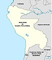
REINO UNIDO DE ECUADOR - PERU - BOLIVIA.jpg 435 × 499; 26 KB


