Category:Maps of proposed US States
Jump to navigation
Jump to search
Media in category "Maps of proposed US States"
The following 40 files are in this category, out of 40 total.
-
1850 Vereinigte Staaten von Nord America und Mexico Meyer Deseret Detail 3.JPG 2,592 × 1,944; 1.26 MB
-
8FranklinCounties.png 1,340 × 1,029; 210 KB
-
Absaroka map from contemporary newspaper.jpg 1,340 × 1,101; 224 KB
-
Absaroka outline.png 800 × 632; 55 KB
-
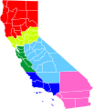
Cal3 Map.png 511 × 857; 66 KB
-
Cal3 map.svg 621 × 733; 255 KB
-
CaliFOURnia map.svg 621 × 733; 255 KB
-
State of Deseret, vector image - 2011.svg 371 × 398; 19 KB
-
State of Deseret, vector image cropped - 2011.svg 320 × 310; 29 KB
-
Utah Territory with Deseret Border, vector image - 2011.svg 320 × 310; 29 KB
-
Wpdms deseret utah territory legend.png 300 × 360; 67 KB
-
Forgottonia.png 167 × 300; 27 KB
-
Map of Tennessee highlighting Former State of Franklin.png 1,024 × 251; 84 KB
-
LINCOLN (TEXAS).png 440 × 314; 17 KB
-
LINCOLN (WASHINGTON e IDAHO).png 587 × 307; 21 KB
-
Lincoln in TX.png 450 × 316; 10 KB
-
Lincoln in United States.svg 3,440 × 2,199; 678 KB
-
Lincoln in WA and ID.png 450 × 316; 11 KB
-
Lincoln in WA and ID.svg 280 × 280; 383 KB
-
Map of Alabama highlighting the 'Republic of Winston'.svg 3,379 × 5,346; 94 KB
-
Map of Liberty.svg 1,781 × 1,159; 231 KB
-
Map of the State of Superior (proposed).svg 238 × 206; 79 KB
-
Map of USA AB.png 286 × 186; 32 KB
-
Map of usa highlighting jefferson.png 280 × 183; 42 KB
-
Nc51map.png 641 × 753; 82 KB
-
New California map.svg 641 × 753; 272 KB
-
North Colorado.png 1,000 × 724; 108 KB
-
Pacific Islands as 51st state of the US.jpg 715 × 628; 102 KB
-
Proposed state of kanawha.jpg 750 × 500; 105 KB
-
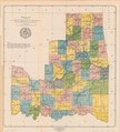
IndianTerritory.jpg 1,000 × 1,061; 233 KB
-
Sequoyah map.jpg 4,390 × 4,820; 9.65 MB
-
Six Californias.png 596 × 676; 13 KB
-
Six Californias.svg 621 × 733; 255 KB
-
State of Jefferson.png 180 × 289; 30 KB
-
State of Sequoyah LOC 2013592417.jpg 4,749 × 5,267; 3.46 MB
-
State of Sequoyah LOC 2013592417.tif 4,749 × 5,267; 71.56 MB
-
Superior-Proposed-State-Expanded.png 345 × 300; 52 KB
-
US-McD.Terr.(1961).svg 26 × 22; 18 KB
-
Westsylvaniamap.png 1,000 × 1,000; 1.7 MB


