Category:Maps of powiat otwocki
Jump to navigation
Jump to search
Subcategories
This category has the following 2 subcategories, out of 2 total.
Media in category "Maps of powiat otwocki"
The following 8 files are in this category, out of 8 total.
-
Gminy powiatu otwockiego.png 240 × 240; 4 KB
-
Izoplety2.jpg 753 × 725; 219 KB
-
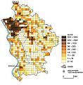
Kartogram-grid.jpg 761 × 777; 102 KB
-
Mapa kropkowa powiat otwocki.jpg 675 × 738; 88 KB
-
Mazowsze Otwocki.png 349 × 393; 12 KB
-
Otwock County administrative map-PL.svg 365 × 505; 2.69 MB
-
POL powiat otwocki map.svg 722 × 962; 20 KB
-
Powiat otwocki location map.png 721 × 998; 293 KB


