Category:Maps of ports and harbours
Jump to navigation
Jump to search
Subcategories
This category has the following 11 subcategories, out of 11 total.
A
- Maps of the Port of Antwerp (40 F)
G
- Maps of Port of Gdynia (15 F)
K
- Maps of the Port of Keelung (12 F)
P
R
Media in category "Maps of ports and harbours"
The following 36 files are in this category, out of 36 total.
-
Ports.png 800 × 503; 204 KB
-
S.C. Gedde - Kort over Christianshavn, Holmen og Flådens Leje - 1751.png 9,100 × 8,992; 168.29 MB
-
1886 map - Atlas des ports étrangers.pdf 1,514 × 1,962, 53 pages; 79.74 MB
-
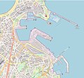
ESP — Port of A Coruña — OpenStreetMap 2023 — Mattes.jpg 3,728 × 3,484; 3.87 MB
-
A Plan of English Harbour WDL655.png 1,024 × 1,454; 2.76 MB
-
Christianshavn 1751 by Samuel Christoph Gedde.jpg 5,000 × 3,300; 1.65 MB
-
Civil engineering; a plan to improve the silted-up harbour a Wellcome V0024378.jpg 2,102 × 3,321; 2.57 MB
-
DOD Selected Airports and Seaports.png 549 × 341; 23 KB
-
EB1911 - Harbour - Fig. 1.—Venetian Lagoon Harbour.jpg 522 × 839; 69 KB
-
EB1911 - Harbour - Fig. 2.—Ostend.jpg 728 × 483; 53 KB
-
EB1911 - Harbour - Fig. 3.—Genoa.jpg 757 × 377; 42 KB
-
EB1911 - Harbour - Fig. 4.—Peterhead.jpg 388 × 392; 31 KB
-
EB1911 - Harbour - Fig. 5.—Colombo.jpg 324 × 448; 22 KB
-
EB1911 - Harbour - Fig. 6.—Sunderland.jpg 284 × 313; 17 KB
-
EB1911 - Harbour - Fig. 7.—Zeebrugge.jpg 480 × 479; 31 KB
-
Port Gdańsk granice.jpg 2,482 × 1,754; 1.32 MB
-
Ports and terminal facilities (1918) (14761470835).jpg 2,800 × 1,864; 919 KB
-
I-264 Berkley Bridge Map.png 1,026 × 775; 618 KB
-
Karte Hamburger Hafen nördlich der Norderelbe.png 2,763 × 1,733; 1.89 MB
-
Major Soviet Maritime Ports, Airports, and Sea Routes, 1986.png 1,386 × 901; 745 KB
-
Map of the Port of Tianjin (2015 explosions).svg 4,085 × 2,492; 613 KB
-
Map of the Port of Tianjin and its Approaches.svg 4,085 × 2,492; 672 KB
-
Mediterranean Indian Seaports.jpg 4,550 × 3,950; 6.85 MB
-
The harbor of Annapolis (NYPL b14950964-1260097).jpg 5,867 × 5,104; 4.79 MB
-
Pillau (Karte).jpg 1,604 × 1,722; 931 KB
-
Port Qasim Location Map.jpg 1,000 × 574; 111 KB
-
PortQasimKarachi.svg 744 × 914; 1.29 MB
-
Portstatecontrol.svg 940 × 477; 1.85 MB
-
Six Harbour Walk.jpg 570 × 800; 120 KB
-
Tianjin Port Planning Map 2030.svg 3,974 × 2,563; 277 KB
-
Схема кмтп.jpg 3,200 × 1,920; 1.79 MB
-
天津港地图.svg 4,085 × 2,492; 672 KB
-
天津港地图(含爆炸位置).svg 4,085 × 2,492; 673 KB
-
天津港地图(含爆炸位置)(部分).png 2,093 × 1,143; 947 KB


