Category:Maps of past tectonic plates
Jump to navigation
Jump to search
Media in category "Maps of past tectonic plates"
The following 138 files are in this category, out of 138 total.
-
100 global.png 737 × 736; 109 KB
-
220Ma Paleomap.svg 3,000 × 1,500; 154 KB
-
230 Ma plate tectonic reconstruction.png 948 × 954; 174 KB
-
237 Ma orogenies reconstruction.jpg 1,058 × 794; 107 KB
-
237 Ma plate tectonic reconstruction.jpg 465 × 412; 43 KB
-
249 global.png 766 × 771; 143 KB
-
280 Ma plate tectonic reconstruction.png 563 × 596; 82 KB
-
290 global.png 780 × 783; 133 KB
-
380 Ma plate tectonic reconstruction.png 557 × 608; 76 KB
-
Alfred Wegener - Pangaea.jpg 720 × 380; 131 KB
-
Antieke kontinente.jpg 603 × 667; 126 KB
-
Arabic-Snider-Pellegrini Wegener fossil map.png 577 × 443; 115 KB
-
Astrobleme Europe.jpg 612 × 493; 159 KB
-
Avalonia Baltica geologi.png 949 × 898; 737 KB
-
Avalonia today.jpg 1,517 × 759; 240 KB
-
Avalonia-480Ma.jpg 759 × 759; 78 KB
-
AVALONIA.jpg 781 × 633; 108 KB
-
AVALONIA.svg 784 × 367; 49 KB
-
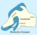
Avalonië-Devoon.svg 360 × 346; 12 KB
-
Baltica 1100 Ma.png 1,497 × 815; 381 KB
-
Baltica outline.png 1,497 × 815; 228 KB
-
BeforeTheAtlantic.pdf 1,752 × 1,185; 458 KB
-
BurbankRiverMap.jpg 3,508 × 1,120; 433 KB
-
Caledonides CS.svg 630 × 421; 126 KB
-
Caledonides DE.svg 630 × 421; 98 KB
-
Caledonides EN.svg 630 × 421; 126 KB
-
Caledonides FR.svg 630 × 421; 127 KB
-
Caledonides Km.jpg 2,625 × 1,755; 1.4 MB
-
Caledonides KM.png 2,625 × 1,755; 17.6 MB
-
Caledonides KM.svg 512 × 342; 47 KB
-
Caledonides NL.svg 630 × 421; 126 KB
-
Cambrianmap.svg 320 × 210; 94 KB
-
CAMP Magmatism in the context of Pangea.jpg 553 × 625; 40 KB
-
CARNIAN EARTH.jpg 720 × 540; 126 KB
-
Cratons West Gondwana and EAO v2.png 629 × 599; 157 KB
-
Cratons West Gondwana and EAO.png 629 × 599; 153 KB
-
Cratons West Gondwana AR.svg 745 × 710; 170 KB
-
Cratons West Gondwana IT.svg 745 × 710; 170 KB
-
Cratons West Gondwana-es.svg 745 × 710; 196 KB
-
Cratons West Gondwana.svg 745 × 710; 170 KB
-
De Wegener Kontinente 018.jpg 712 × 1,200; 277 KB
-
Early Carboniferous.png 2,449 × 1,520; 2.01 MB
-
Early to Middle Jurassic Iberia.jpg 1,772 × 1,743; 1.09 MB
-
Eocene-Paleocene-circumpolar.svg 775 × 1,158; 226 KB
-
Es-Laurasia-Gondwana.png 728 × 625; 110 KB
-
Euramerica en.svg 831 × 594; 257 KB
-
Europrobe - Avalonia Basement Europe.png 1,283 × 1,317; 53 KB
-
Evolution of MTJ.JPG 1,141 × 418; 81 KB
-
Fanerozoicobrasil1.png 3,462 × 2,294; 3.17 MB
-
Fig2-5globes.gif 623 × 777; 59 KB
-
Gondbreak.png 514 × 343; 13 KB
-
Gondwana 420 Ma.png 807 × 791; 631 KB
-
Gondwana and Laurentia.png 2,048 × 2,048; 2.56 MB
-
Gondwana Nederlandse versie.png 577 × 443; 114 KB
-
Gondwana, China and Siberia.png 2,048 × 2,048; 2.13 MB
-
Gondwana038ma hg.png 620 × 463; 77 KB
-
Gondwana053Ma hg.png 620 × 463; 21 KB
-
Gondwana065Ma hg.png 620 × 463; 78 KB
-
Gondwana080Ma hg.png 620 × 463; 78 KB
-
Gondwana115Ma hg.png 620 × 463; 19 KB
-
Hercynides CS.svg 550 × 370; 108 KB
-
Hercynides DE.svg 550 × 370; 109 KB
-
Hercynides EN.svg 550 × 370; 108 KB
-
Hercynides IT.svg 550 × 370; 87 KB
-
Hercynides Km.jpg 2,292 × 1,543; 835 KB
-
Hercynides NL.svg 550 × 370; 108 KB
-
India 71-0 Ma.gif 442 × 743; 104 KB
-
Kimméria és a Tethys-öböl.jpg 766 × 1,755; 1.17 MB
-
Kontinenternas vandringar Trias o Krita.PNG 845 × 397; 369 KB
-
Kuunga2.jpg 1,000 × 785; 215 KB
-
Kuunga2.png 1,150 × 920; 153 KB
-
Late Carboniferous.png 2,449 × 1,520; 2.16 MB
-
Laurasia-Gondwana fr.png 692 × 482; 101 KB
-
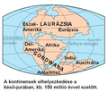
Laurasia-Gondwana hu.PNG 728 × 625; 102 KB
-
Laurasia-Gondwana ml.svg 519 × 435; 30 KB
-
Laurasia-Gondwana-fr.svg 519 × 435; 25 KB
-
Laurasia-Gondwana-HE.svg 519 × 435; 31 KB
-
Laurasia-Gondwana-hu.svg 519 × 435; 25 KB
-
Laurasia-Gondwana-it.svg 519 × 435; 27 KB
-
Laurasia-Gondwana-ka.svg 519 × 435; 29 KB
-
Laurasia-Gondwana-pl.svg 519 × 435; 25 KB
-
Laurasia-Gondwana-ru.svg 519 × 435; 25 KB
-
Laurasia-Gondwana-sv.svg 519 × 435; 28 KB
-
Laurasia-Gondwana-uk.svg 519 × 435; 25 KB
-
Laurasia-Gondwana.png 728 × 625; 116 KB
-
Laurasiyop-Gondvanop.png 728 × 625; 85 KB
-
Laurazie-Gondwana NL.png 728 × 625; 126 KB
-
Laurussia Euramerica.svg 740 × 732; 557 KB
-
Laurussia fr.svg 830 × 618; 601 KB
-
Mediterranean Rupelian.jpg 1,038 × 747; 294 KB
-
MWestCarpJ.png 1,200 × 817; 249 KB
-
North America subduction.jpg 291 × 374; 20 KB
-
North America subduction1.jpg 291 × 374; 19 KB
-
Opening of eastern Indian Ocean 120 Ma.png 804 × 804; 662 KB
-
Opening of eastern Indian Ocean 40 Ma.png 804 × 804; 1,005 KB
-
Opening of eastern Indian Ocean 80 Ma.png 804 × 804; 767 KB
-
Opening of South Atlantic 126 Ma.png 798 × 798; 711 KB
-
Opening of South Atlantic 83 Ma.png 798 × 798; 906 KB
-
Opening of western Indian Ocean 150 Ma.png 791 × 790; 809 KB
-
Opening of western Indian Ocean 70 Ma.png 791 × 790; 942 KB
-
Pacific Ocean 180Ma.jpg 1,517 × 759; 189 KB
-
Paleoglobe NO 1040 mya.gif 960 × 720; 149 KB
-
Paleoglobe NO 1260 mya.gif 960 × 720; 123 KB
-
Paleoglobe NO 1590 mya-vector-colors.svg 960 × 720; 121 KB
-
Paleoglobe NO 1590 mya.gif 960 × 720; 157 KB
-
Paleoglobe NO 1740 mya.gif 960 × 720; 151 KB
-
Paléotéthys.jpg 794 × 359; 95 KB
-
Pangaea (230 million years ago).png 550 × 400; 88 KB
-
Pangaea 200Ma.jpg 1,519 × 759; 148 KB
-
Pangaea bis Gegenwart Weltkarten.gif 639 × 784; 116 KB
-
Pangaea italiano.png 758 × 853; 83 KB
-
Pangaea to present cy.png 623 × 777; 511 KB
-
Pangäa.jpg 2,154 × 2,929; 258 KB
-
Panotiaggg.jpg 411 × 208; 21 KB
-
Panthalassa 250Ma.jpg 1,519 × 759; 129 KB
-
Permian Period.jpg 1,037 × 827; 155 KB
-
Position Urkontinent Baltika mit Baltikum.jpg 729 × 731; 386 KB
-
Positions of ancient continents, 550 million years ago.jpg 820 × 820; 426 KB
-
Pt-Laurasia-Gondwana.png 728 × 625; 109 KB
-
RHAETIC EARTH.jpg 720 × 540; 179 KB
-
Rifting model.png 631 × 493; 11 KB
-
Rodinia reconstruction.ar.png 601 × 534; 219 KB
-
Snider-Pellegrini Wegener fossil map-i18n.png 577 × 443; 87 KB
-
Snider-Pellegrini Wegener fossil map-ja.svg 571 × 441; 44 KB
-
Snider-Pellegrini Wegener fossil map.gif 577 × 443; 46 KB
-
Snider-Pellegrini Wegener fossil mapa es.svg 580 × 446; 90 KB
-
Tectonic plate model 1Ga.webm 40 s, 800 × 480; 5.33 MB
-
Tectonica.jpg 2,122 × 1,262; 601 KB
-
Terra Australis orogen 180Ma.jpg 995 × 994; 165 KB
-
Triassic 250.png 1,542 × 794; 177 KB
-
TRIASSIC EARTH.jpg 624 × 520; 112 KB
-
Valbara map.png 239 × 92; 10 KB
-
Önceden rodinya.png 220 × 165; 26 KB
-
רודיניה.png 1,259 × 1,142; 940 KB


