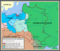
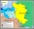
Category:Maps of partitions of Poland
Jump to navigation
Jump to search
Subcategories
This category has the following 3 subcategories, out of 3 total.
M
O
S
Media in category "Maps of partitions of Poland"
The following 56 files are in this category, out of 56 total.
-
17 of 'A Girl in the Karpathians. ... Third edition' (11212375116).jpg 2,867 × 2,145; 1.14 MB
-
Poland 1772 map.jpg 775 × 568; 117 KB
-
Rzeczpospolita Rozbiory 3.png 1,906 × 1,568; 325 KB
-
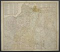
Charte des Königreichs Polen.jpg 8,515 × 7,046; 15.91 MB
-
D606- N° 419. Premier partage de la Pologne. - liv3-ch15.png 1,440 × 1,590; 347 KB
-
D607- N° 420. Deuxième et troisième partages de la Pologne. - liv3-ch15.png 1,438 × 1,582; 245 KB
-
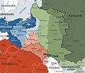
Europe 1783-1792 en.png 3,872 × 2,761; 1.24 MB
-
First Partition of Poland 1772.PNG 1,988 × 1,564; 230 KB
-
First Partition of Poland1772.png 1,988 × 1,564; 248 KB
-
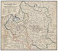
Geographical and statistical map of Poland and Hungary, 1813.jpg 3,024 × 2,431; 2.61 MB
-
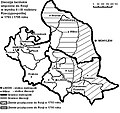
Karte polnischeteilungen4.jpg 1,344 × 1,149; 932 KB
-
Map Austria and the spartitions of Poland 1928-1940 - Touring Club Italiano CART-TRC-60.jpg 6,290 × 6,846; 4.53 MB
-
Mediæval and modern history (1920) (14587180628).jpg 1,408 × 2,306; 676 KB
-
Partition Poland 1793.jpg 768 × 560; 104 KB
-
Partitioned Poland & the 2nd Republic (1772-1939).png 1,906 × 1,518; 443 KB
-
Partitioned Poland & the 2nd Republic (Chełm Land, Ziemia chełmska).png 1,814 × 1,496; 441 KB
-
Partitioned Poland & the 2nd Republic.png 1,798 × 1,518; 433 KB
-
Partitions of Poland german.png 2,000 × 1,568; 849 KB
-
Partitions of Poland-ar.png 2,000 × 1,568; 242 KB
-
Partitions of Poland.png 2,000 × 1,568; 261 KB
-
Poland 1793 map.jpg 768 × 560; 100 KB
-
Poland 1795 map.jpg 777 × 571; 146 KB
-
Poland Partition Gif.gif 600 × 338; 91 KB
-
Polonha - Partiments de Polonha.png 1,592 × 4,498; 904 KB
-
Review of reviews and world's work (1890) (14793347573).jpg 2,714 × 3,980; 1.47 MB
-
Rzeczpospolita Rozbiory 1.png 2,000 × 1,568; 234 KB
-
Rzeczpospolita Rozbiory 2.png 1,902 × 1,568; 296 KB
-
Rzeczpospolita Rozbiory 3 de.png 2,000 × 1,568; 293 KB
-
Rzeczpospolita Rozbiory 4.png 2,000 × 1,568; 211 KB
-
Rzeczpospolita Rozbiory 4a.png 2,000 × 1,568; 290 KB
-
Rzeczpospolitapodrozb.png 700 × 600; 247 KB
-
Second Partition of Poland 1793.PNG 2,000 × 1,568; 256 KB
-
South Prussia 1795–1806 administrative map with departments, districts and all towns.jpg 3,000 × 2,225; 1.38 MB
-
Stolen lands (ziemie zabrane).PNG 1,578 × 1,352; 532 KB
-
Territorial changes of Poland 1772.jpg 850 × 700; 200 KB
-
Territorial changes of Poland 1793.jpg 850 × 700; 184 KB
-
The Partitions of Poland, H. G. Wells' Outline of History, page 427.jpg 2,064 × 2,280; 775 KB
-
Карта новопріобретеннымъ отъ Польши Россіею областямъ въ 1793 году.jpg 2,643 × 2,211; 1.37 MB
-
Польша-до-разделов.png 2,000 × 1,568; 115 KB
-
Разделы-Польши.gif 2,000 × 1,568; 140 KB
-
Разделы-Польши1 новые цвета.gif 2,000 × 1,568; 516 KB
-
Разделы-Польши1.png 2,000 × 1,568; 102 KB
-
Разделы-Польши2.png 2,000 × 1,568; 104 KB
-
Розподіл Польщі.jpg 2,000 × 1,568; 831 KB
-
폴란드 분할 지도.png 1,906 × 1,568; 312 KB
-
폴란드 분할.png 1,906 × 1,568; 245 KB


