Category:Maps of nature parks in Germany
Jump to navigation
Jump to search
Media in category "Maps of nature parks in Germany"
The following 124 files are in this category, out of 124 total.
-
Karte Naturparks Deutschland high.png 2,338 × 3,121; 925 KB
-
Karte Naturparks Deutschland.png 1,125 × 1,500; 817 KB
-
Karte Deutsch-Luxemburgischer Naturpark.png 752 × 1,000; 295 KB
-
Karte Naturpark Altmühltal.png 750 × 1,000; 201 KB
-
Karte Naturpark Am Stettiner Haff.png 750 × 1,000; 265 KB
-
Karte Naturpark Ammergauer Alpen.png 750 × 1,000; 182 KB
-
Karte Naturpark Arnsberger Wald.png 750 × 1,000; 201 KB
-
Karte Naturpark Augsburg-Westliche Wälder.png 750 × 1,000; 203 KB
-
Karte Naturpark Aukrug.png 750 × 1,000; 201 KB
-
Karte Naturpark Barnim.png 750 × 1,000; 200 KB
-
Karte Naturpark Bayerische Rhön.png 750 × 1,000; 201 KB
-
Karte Naturpark Bayerischer Spessart.png 750 × 1,000; 202 KB
-
Karte Naturpark Bayerischer Wald.png 750 × 1,000; 202 KB
-
Karte Naturpark Bergisches Land.png 750 × 1,000; 202 KB
-
Karte Naturpark Bergstraße-Odenwald.png 752 × 1,000; 194 KB
-
Karte Naturpark Bourtanger Moor-Bargerveen.png 750 × 1,000; 202 KB
-
Karte Naturpark Dahme-Heideseen.png 750 × 1,000; 201 KB
-
Karte Naturpark Diemelsee.png 750 × 1,000; 201 KB
-
Karte Naturpark Drömling.png 750 × 1,000; 201 KB
-
Karte Naturpark Dübener Heide.png 750 × 1,000; 201 KB
-
Karte Naturpark Dümmer.png 750 × 1,000; 206 KB
-
Karte Naturpark Ebbegebirge.png 750 × 1,000; 201 KB
-
Karte Naturpark Eichsfeld-Hainich-Werratal.png 750 × 1,000; 202 KB
-
Karte Naturpark Elbhöhen-Wendland.png 750 × 1,000; 208 KB
-
Karte Naturpark Elm-Lappwald.png 750 × 1,000; 201 KB
-
Karte Naturpark Erzgebirge-Vogtland.png 750 × 1,000; 202 KB
-
Karte Naturpark Feldberger Seenlandschaft.png 750 × 1,000; 265 KB
-
Karte Naturpark Fichtelgebirge.png 750 × 1,000; 201 KB
-
Karte Naturpark Flusslandschaft Peenetal.png 750 × 1,000; 195 KB
-
Karte Naturpark Fläming.png 750 × 1,000; 200 KB
-
Karte Naturpark Frankenhöhe.png 750 × 1,000; 201 KB
-
Karte Naturpark Frankenwald.png 750 × 1,000; 201 KB
-
Karte Naturpark Fränkische Schweiz-Veldensteiner Forst.png 750 × 1,000; 204 KB
-
Karte Naturpark Habichtswald.png 750 × 1,000; 201 KB
-
Karte Naturpark Harz (Niedersachsen).png 751 × 1,000; 204 KB
-
Karte Naturpark Harz Sachsen-Anhalt Mansfelder Land.png 751 × 1,000; 109 KB
-
Karte Naturpark Harz Sachsen-Anhalt.png 752 × 1,000; 203 KB
-
Karte Naturpark Harz.png 750 × 1,000; 202 KB
-
Karte Naturpark Haßberge.png 750 × 1,000; 201 KB
-
Karte Naturpark Hessische Rhön.png 750 × 1,000; 201 KB
-
Karte Naturpark Hessischer Spessart.png 750 × 1,000; 201 KB
-
Karte Naturpark Hirschwald.png 750 × 1,000; 201 KB
-
Karte Naturpark Hohe Mark.png 750 × 1,000; 293 KB
-
Karte Naturpark Hoher Fläming.png 750 × 1,000; 201 KB
-
Karte Naturpark Hoher Vogelsberg.png 750 × 1,000; 202 KB
-
Karte Naturpark Hohes Venn-Eifel.png 750 × 1,000; 202 KB
-
Karte Naturpark Holsteinische Schweiz.png 750 × 1,000; 202 KB
-
Karte Naturpark Homert.png 750 × 1,000; 201 KB
-
Karte Naturpark Hümmling.png 750 × 1,000; 222 KB
-
Karte Naturpark Hüttener Berge.png 750 × 1,000; 201 KB
-
Karte Naturpark Insel Usedom.png 750 × 1,000; 194 KB
-
Karte Naturpark Kellerwald-Edersee.png 746 × 996; 201 KB
-
Karte Naturpark Kyffhäuser.png 750 × 1,000; 201 KB
-
Karte Naturpark Lahn-Dill-Bergland.png 750 × 1,000; 302 KB
-
Karte Naturpark Lauenburgische Seen.png 750 × 1,000; 201 KB
-
Karte Naturpark Lüneburger Heide.png 750 × 1,000; 202 KB
-
Karte Naturpark Maas-Schwalm-Nette.png 750 × 1,000; 202 KB
-
Karte Naturpark Mecklenburgische Schweiz und Kummerower See.png 750 × 1,000; 197 KB
-
Karte Naturpark Mecklenburgisches Elbetal.png 750 × 1,000; 265 KB
-
Karte Naturpark Meißner-Kaufunger Wald.png 750 × 1,000; 222 KB
-
Karte Naturpark Märkische Schweiz.png 750 × 1,000; 201 KB
-
Karte Naturpark Münden.png 750 × 1,000; 200 KB
-
Karte Naturpark Nagelfluhkette.png 750 × 1,000; 271 KB
-
Karte Naturpark Nassau.png 750 × 1,000; 200 KB
-
Karte Naturpark Neckartal-Odenwald.png 750 × 1,000; 202 KB
-
Karte Naturpark Niederlausitzer Heidelandschaft.png 750 × 1,000; 202 KB
-
Karte Naturpark Niederlausitzer Landrücken.png 750 × 1,000; 202 KB
-
Karte Naturpark Nossentiner-Schwinzer Heide.png 750 × 1,000; 266 KB
-
Karte Naturpark Nuthe-Nieplitz.png 750 × 1,000; 201 KB
-
Karte Naturpark Nördlicher Oberpfälzer Wald.png 750 × 1,000; 203 KB
-
Karte Naturpark Obere Donau.png 750 × 1,000; 202 KB
-
Karte Naturpark Oberer Bayerischer Wald.png 750 × 1,000; 202 KB
-
Karte Naturpark Oberpfälzer Wald.png 750 × 1,000; 202 KB
-
Karte Naturpark Pfälzerwald.png 750 × 1,000; 201 KB
-
Karte Naturpark Reinhardswald.png 750 × 1,000; 224 KB
-
Karte Naturpark Rhein-Taunus.png 750 × 1,000; 200 KB
-
Karte Naturpark Rhein-Westerwald.png 750 × 1,000; 201 KB
-
Karte Naturpark Rheinland.png 750 × 1,000; 202 KB
-
Karte Naturpark Rothaargebirge.png 750 × 1,000; 201 KB
-
Karte Naturpark Saale-Unstrut-Triasland.png 750 × 1,000; 207 KB
-
Karte Naturpark Saar-Hunsrück.png 750 × 1,000; 201 KB
-
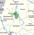
Karte Naturpark Sauerland-Rothaargebirge Vorläufer.png 801 × 735; 64 KB
-
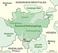
Karte Naturpark Sauerland-Rothaargebirge.png 750 × 1,000; 111 KB
-
Karte Naturpark Schlaubetal.png 750 × 1,000; 201 KB
-
Karte Naturpark Schlei.png 1,794 × 1,506; 2.94 MB
-
Karte Naturpark Schwarzwald Mitte-Nord.png 750 × 1,000; 204 KB
-
Karte Naturpark Schwäbisch-Fränkischer Wald.png 750 × 1,000; 203 KB
-
Karte Naturpark Schönbuch.png 750 × 1,000; 201 KB
-
Karte Naturpark Siebengebirge.png 750 × 1,000; 201 KB
-
Karte Naturpark Solling-Vogler.png 750 × 1,000; 201 KB
-
Karte Naturpark Soonwald-Nahe.png 750 × 1,000; 201 KB
-
Karte Naturpark Spessart gesamt.png 750 × 1,000; 205 KB
-
Karte Naturpark Stechlin-Ruppiner Land.png 750 × 1,000; 202 KB
-
Karte Naturpark Steigerwald blank.png 750 × 1,000; 180 KB
-
Karte Naturpark Steigerwald.png 750 × 1,000; 201 KB
-
Karte Naturpark Steinhuder Meer.png 750 × 1,000; 201 KB
-
Karte Naturpark Steinwald.png 750 × 1,000; 201 KB
-
Karte Naturpark Sternberger Seenland.png 750 × 1,000; 199 KB
-
Karte Naturpark Stromberg-Heuchelberg.png 750 × 1,000; 202 KB
-
Karte Naturpark Südharz.png 744 × 994; 245 KB
-
Karte Naturpark Südheide.png 750 × 1,000; 201 KB
-
Karte Naturpark Südschwarzwald.png 750 × 1,000; 202 KB
-
Karte Naturpark Taunus.png 750 × 1,000; 206 KB
-
Karte Naturpark TERRA.vita.png 750 × 1,000; 206 KB
-
Karte Naturpark Teutoburger Wald-Eggegebirge.png 750 × 1,000; 205 KB
-
Karte Naturpark Thüringer Schiefergebirge-Obere Saale.png 750 × 1,000; 203 KB
-
Karte Naturpark Thüringer Wald.png 750 × 1,000; 203 KB
-
Karte Naturpark Uckermärkische Seen.png 750 × 1,000; 202 KB
-
Karte Naturpark Unteres Saaletal.png 750 × 1,000; 202 KB
-
Karte Naturpark Vulkaneifel.png 750 × 1,000; 286 KB
-
Karte Naturpark Weserbergland.png 750 × 1,000; 202 KB
-
Karte Naturpark Westensee.png 750 × 1,000; 201 KB
-
Karte Naturpark Westhavelland.png 750 × 1,000; 201 KB
-
Karte Naturpark Wildeshauser Geest.png 750 × 1,000; 203 KB
-
Karte Naturpark Zittauer Gebirge.png 750 × 1,000; 201 KB
-
Karte naturparke.png 605 × 800; 388 KB
-
Karte Naturparks Deutschland high Arbeitsversion.png 2,341 × 3,122; 867 KB
-
Naturpark Hümmling Lage.png 750 × 1,000; 298 KB
-
Naturpark Obere Donau Karte.jpg 2,500 × 1,850; 571 KB
-
Naturpark Schlei.png 750 × 1,000; 274 KB
-
SLH.nature.png 930 × 785; 322 KB
-
Trebitz, Karte Unteres Saaletal.jpg 3,171 × 2,379; 1.4 MB
-
Übersichtskarte Naturpark Hohe Mark, Westruper Heide.JPG 4,320 × 3,240; 4.18 MB


