Category:Maps of municipalities of the province of Massa-Carrara
Jump to navigation
Jump to search
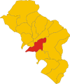
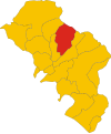
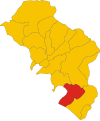
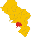
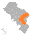
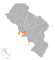
English: Maps of municipalities of the province of Massa-Carrara, region Tuscany, Italy
Italiano: Mappe dei comuni della provincia di Massa-Carrara, regione Toscana, Italia
Media in category "Maps of municipalities of the province of Massa-Carrara"
The following 52 files are in this category, out of 52 total.
-
Map of comune of Aulla (province of Massa and Carrara, region Tuscany, Italy).svg 4,003 × 4,805; 38 KB
-
Map of comune of Bagnone (province of Massa and Carrara, region Tuscany, Italy).svg 4,003 × 4,805; 38 KB
-
Map of comune of Carrara (province of Massa and Carrara, region Tuscany, Italy).svg 4,003 × 4,805; 38 KB
-
Map of comune of Comano (province of Massa and Carrara, region Tuscany, Italy).svg 4,003 × 4,805; 38 KB
-
Map of comune of Massa (province of Massa and Carrara, region Tuscany, Italy).svg 4,003 × 4,805; 38 KB
-
Map of comune of Mulazzo (province of Massa and Carrara, region Tuscany, Italy).svg 4,003 × 4,805; 38 KB
-
Map of comune of Tresana (province of Massa and Carrara, region Tuscany, Italy).svg 4,003 × 4,805; 38 KB
-
Map of comune of Zeri (province of Massa and Carrara, region Tuscany, Italy).svg 4,003 × 4,805; 38 KB
-
AullaLocatie.png 212 × 256; 5 KB
-
BagnoneLocatie.png 212 × 256; 5 KB
-
CarraraLocatie.png 212 × 256; 5 KB
-
Casola in LunigianaLocatie.png 212 × 256; 5 KB
-
ComanoLocatie.png 212 × 256; 5 KB
-
FilattieraLocatie.png 212 × 256; 5 KB
-
FivizzanoLocatie.png 212 × 256; 5 KB
-
FosdinovoLocatie.png 212 × 256; 5 KB
-
Licciana NardiLocatie.png 212 × 256; 5 KB
-
Map - IT - Massa-Carrara - Aulla.svg 1,181 × 1,276; 846 KB
-
Map - IT - Massa-Carrara - Bagnone.svg 1,181 × 1,276; 846 KB
-
Map - IT - Massa-Carrara - Blank.svg 1,181 × 1,276; 846 KB
-
Map - IT - Massa-Carrara - Carrara.svg 1,181 × 1,276; 846 KB
-
Map - IT - Massa-Carrara - Casola in Lunigiana.svg 1,181 × 1,276; 846 KB
-
Map - IT - Massa-Carrara - Comano.svg 1,181 × 1,276; 846 KB
-
Map - IT - Massa-Carrara - Filattiera.svg 1,181 × 1,276; 846 KB
-
Map - IT - Massa-Carrara - Fivizzano.svg 1,181 × 1,276; 846 KB
-
Map - IT - Massa-Carrara - Fosdinovo.svg 1,181 × 1,276; 846 KB
-
Map - IT - Massa-Carrara - Licciana Nardi.svg 1,181 × 1,276; 846 KB
-
Map - IT - Massa-Carrara - Massa.svg 1,181 × 1,276; 846 KB
-
Map - IT - Massa-Carrara - Montignoso.svg 1,181 × 1,276; 846 KB
-
Map - IT - Massa-Carrara - Mulazzo.svg 1,181 × 1,276; 846 KB
-
Map - IT - Massa-Carrara - Podenzana.svg 1,181 × 1,276; 846 KB
-
Map - IT - Massa-Carrara - Pontremoli.svg 1,181 × 1,276; 846 KB
-
Map - IT - Massa-Carrara - Tresana.svg 1,181 × 1,276; 846 KB
-
Map - IT - Massa-Carrara - Villafranca in Lunigiana.svg 1,181 × 1,276; 846 KB
-
Map - IT - Massa-Carrara - Zeri.svg 1,181 × 1,276; 846 KB
-
MassaLocatie.png 212 × 256; 5 KB
-
MontignosoLocatie.png 212 × 256; 5 KB
-
MulazzoLocatie.png 212 × 256; 5 KB
-
PodenzanaLocatie.png 212 × 256; 5 KB
-
PontremoliLocatie.png 212 × 256; 5 KB
-
TresanaLocatie.png 212 × 256; 5 KB
-
Villafranca in LunigianaLocatie.png 212 × 256; 5 KB
-
ZeriLocatie.png 212 × 256; 5 KB
