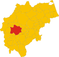
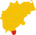
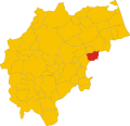
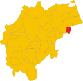
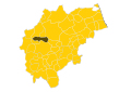
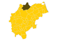
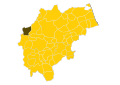
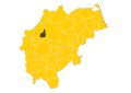
Category:Maps of municipalities of the province of Macerata
Jump to navigation
Jump to search
English: Maps of municipalities of the province of Macerata, region Marche, Italy
Italiano: Mappe dei comuni della provincia di Macerata, regione Marche, Italia
Media in category "Maps of municipalities of the province of Macerata"
The following 117 files are in this category, out of 117 total.
-
 Map of comune of Apiro (province of Macerata, region Marche, Italy).svg 8,349 × 8,064; 115 KB
-
 Map of comune of Appignano (province of Macerata, region Marche, Italy).svg 8,349 × 8,064; 115 KB
-
 Map of comune of Belforte del Chienti (province of Macerata, region Marche, Italy).svg 8,349 × 8,064; 115 KB
-
 Map of comune of Bolognola (province of Macerata, region Marche, Italy).svg 8,349 × 8,064; 115 KB
-
 Map of comune of Caldarola (province of Macerata, region Marche, Italy).svg 8,349 × 8,064; 115 KB
-
 Map of comune of Camerino (province of Macerata, region Marche, Italy).svg 8,349 × 8,064; 115 KB
-

-
 Map of comune of Castelraimondo (province of Macerata, region Marche, Italy).svg 8,349 × 8,064; 115 KB
-
-
 Map of comune of Cessapalombo (province of Macerata, region Marche, Italy).svg 8,349 × 8,064; 115 KB
-
 Map of comune of Cingoli (province of Macerata, region Marche, Italy).svg 8,349 × 8,064; 115 KB
-
 Map of comune of Civitanova Marche (province of Macerata, region Marche, Italy).svg 8,349 × 8,064; 115 KB
-
 Map of comune of Colmurano (province of Macerata, region Marche, Italy).svg 8,349 × 8,064; 115 KB
-
 Map of comune of Corridonia (province of Macerata, region Marche, Italy).svg 8,349 × 8,064; 115 KB
-
 Map of comune of Esanatoglia (province of Macerata, region Marche, Italy).svg 8,349 × 8,064; 115 KB
-

-
 Map of comune of Fiuminata (province of Macerata, region Marche, Italy).svg 8,349 × 8,064; 115 KB
-
 Map of comune of Gagliole (province of Macerata, region Marche, Italy).svg 8,349 × 8,064; 115 KB
-
 Map of comune of Gualdo (province of Macerata, region Marche, Italy).svg 8,349 × 8,064; 115 KB
-
 Map of comune of Loro Piceno (province of Macerata, region Marche, Italy).svg 8,349 × 8,064; 115 KB
-
 Map of comune of Macerata (province of Macerata, region Marche, Italy).svg 8,349 × 8,064; 115 KB
-
 Map of comune of Matelica (province of Macerata, region Marche, Italy).svg 8,349 × 8,064; 115 KB
-
 Map of comune of Mogliano (province of Macerata, region Marche, Italy).svg 8,349 × 8,064; 115 KB
-
 Map of comune of Monte Cavallo (province of Macerata, region Marche, Italy).svg 8,349 × 8,064; 115 KB
-
 Map of comune of Monte San Giusto (province of Macerata, region Marche, Italy).svg 8,349 × 8,064; 115 KB
-
 Map of comune of Monte San Martino (province of Macerata, region Marche, Italy).svg 8,349 × 8,064; 115 KB
-
 Map of comune of Montecassiano (province of Macerata, region Marche, Italy).svg 8,349 × 8,064; 115 KB
-
 Map of comune of Montecosaro (province of Macerata, region Marche, Italy).svg 8,349 × 8,064; 115 KB
-
 Map of comune of Montefano (province of Macerata, region Marche, Italy).svg 8,349 × 8,064; 115 KB
-
 Map of comune of Montelupone (province of Macerata, region Marche, Italy).svg 8,349 × 8,064; 115 KB
-
 Map of comune of Morrovalle (province of Macerata, region Marche, Italy).svg 8,349 × 8,064; 115 KB
-
 Map of comune of Muccia (province of Macerata, region Marche, Italy).svg 8,349 × 8,064; 115 KB
-
 Map of comune of Penna San Giovanni (province of Macerata, region Marche, Italy).svg 8,349 × 8,064; 115 KB
-
 Map of comune of Petriolo (province of Macerata, region Marche, Italy).svg 8,349 × 8,064; 115 KB
-
 Map of comune of Pieve Torina (province of Macerata, region Marche, Italy).svg 8,349 × 8,064; 115 KB
-
 Map of comune of Pioraco (province of Macerata, region Marche, Italy).svg 8,349 × 8,064; 115 KB
-
 Map of comune of Poggio San Vicino (province of Macerata, region Marche, Italy).svg 8,349 × 8,064; 115 KB
-
 Map of comune of Pollenza (province of Macerata, region Marche, Italy).svg 8,349 × 8,064; 115 KB
-
 Map of comune of Porto Recanati (province of Macerata, region Marche, Italy).svg 8,349 × 8,064; 115 KB
-
 Map of comune of Potenza Picena (province of Macerata, region Marche, Italy).svg 8,349 × 8,064; 115 KB
-
 Map of comune of Recanati (province of Macerata, region Marche, Italy).svg 8,349 × 8,064; 115 KB
-
 Map of comune of Ripe San Ginesio (province of Macerata, region Marche, Italy).svg 8,349 × 8,064; 115 KB
-
 Map of comune of San Ginesio (province of Macerata, region Marche, Italy).svg 8,349 × 8,064; 115 KB
-
 Map of comune of San Severino Marche (province of Macerata, region Marche, Italy).svg 8,349 × 8,064; 115 KB
-
 Map of comune of Sant'Angelo in Pontano (province of Macerata, region Marche, Italy).svg 8,349 × 8,064; 115 KB
-
 Map of comune of Sarnano (province of Macerata, region Marche, Italy).svg 8,349 × 8,064; 115 KB
-
 Map of comune of Sefro (province of Macerata, region Marche, Italy).svg 8,349 × 8,064; 115 KB
-
 Map of comune of Serrapetrona (province of Macerata, region Marche, Italy).svg 8,349 × 8,064; 115 KB
-
 Map of comune of Serravalle di Chienti (province of Macerata, region Marche, Italy).svg 8,349 × 8,064; 115 KB
-
 Map of comune of Tolentino (province of Macerata, region Marche, Italy).svg 8,349 × 8,064; 115 KB
-
 Map of comune of Treia (province of Macerata, region Marche, Italy).svg 8,349 × 8,064; 115 KB
-
 Map of comune of Urbisaglia (province of Macerata, region Marche, Italy).svg 8,349 × 8,064; 115 KB
-
 Map of comune of Ussita (province of Macerata, region Marche, Italy).svg 8,349 × 8,064; 115 KB
-
 Map of comune of Visso (province of Macerata, region Marche, Italy).svg 8,349 × 8,064; 115 KB
-
 Map of ex-comune of Acquacanina (province of Macerata, region Marche, Italy).svg 8,349 × 8,064; 114 KB
-
 Map of ex-comune of Fiordimonte (province of Macerata, region Marche, Italy).svg 8,349 × 8,064; 114 KB
-
 Map of ex-comune of Pievebovigliana (province of Macerata, region Marche, Italy).svg 8,349 × 8,064; 114 KB
-
 Provincia Macerata-Locatie.svg 1,052 × 744; 173 KB
-
 Acquacanina-Locatie.svg 1,052 × 744; 236 KB
-
 Apiro-Locatie.svg 1,052 × 744; 236 KB
-
 Appignano-Locatie.svg 1,052 × 744; 236 KB
-
 Belforte del Chienti-Locatie.svg 1,052 × 744; 236 KB
-
 Bolognola-Locatie.svg 1,052 × 744; 236 KB
-
 Caldarola-Locatie.svg 1,052 × 744; 236 KB
-
 Camerino-Locatie.svg 1,052 × 744; 236 KB
-
 Camporotondo di Fiastrone-Locatie.svg 1,052 × 744; 236 KB
-
 Castelraimondo-Locatie.svg 1,052 × 744; 236 KB
-
 Castelsantangelo sul Nera-Locatie.svg 1,052 × 744; 236 KB
-
 Cessapalombo-Locatie.svg 1,052 × 744; 236 KB
-
 Cingoli-Locatie.svg 1,052 × 744; 236 KB
-
 Civitanova Marche-Locatie.svg 1,052 × 744; 236 KB
-
 Colmurano-Locatie.svg 1,052 × 744; 236 KB
-
 Corridonia-Locatie.svg 1,052 × 744; 236 KB
-
 Esanatoglia-Locatie.svg 1,052 × 744; 236 KB
-
 Fiastra-Locatie.svg 1,052 × 744; 236 KB
-
 Fiordimonte-Locatie.svg 1,052 × 744; 236 KB
-
 Fiuminata-Locatie.svg 1,052 × 744; 236 KB
-
 Gagliole-Locatie.svg 1,052 × 744; 236 KB
-
 Gualdo-Locatie.svg 1,052 × 744; 236 KB
-
 Loro Piceno-Locatie.svg 1,052 × 744; 236 KB
-
 Macerata-Locatie.svg 1,052 × 744; 236 KB
-
-
 Map of comune of Valfornace (province of Macerata, region Marche, Italy).svg 8,349 × 8,064; 115 KB
-
 Matelica-Locatie.svg 1,052 × 744; 236 KB
-
 Mogliano-Locatie.svg 1,052 × 744; 236 KB
-
 Monte Cavallo-Locatie.svg 1,052 × 744; 236 KB
-
 Monte San Giusto-Locatie.svg 1,052 × 744; 236 KB
-
 Monte San Martino-Locatie.svg 1,052 × 744; 236 KB
-
 Montecassiano-Locatie.svg 1,052 × 744; 236 KB
-
 Montecosaro-Locatie.svg 1,052 × 744; 236 KB
-
 Montefano-Locatie.svg 1,052 × 744; 236 KB
-
 Montelupone-Locatie.svg 1,052 × 744; 236 KB
-
 Morrovalle-Locatie.svg 1,052 × 744; 236 KB
-
 Muccia-Locatie.svg 1,052 × 744; 236 KB
-
 Penna San Giovanni-Locatie.svg 1,052 × 744; 236 KB
-
 Petriolo-Locatie.svg 1,052 × 744; 236 KB
-
 Pieve Torina-Locatie.svg 1,052 × 744; 236 KB
-
 Pievebovigliana-Locatie.svg 1,052 × 744; 236 KB
-
 Pioraco-Locatie.svg 1,052 × 744; 236 KB
-
 Poggio San Vicino-Locatie.svg 1,052 × 744; 236 KB
-
 Pollenza-Locatie.svg 1,052 × 744; 236 KB
-
 Porto Recanati-Locatie.svg 1,052 × 744; 236 KB
-
 Potenza Picena-Locatie.svg 1,052 × 744; 236 KB
-
 Recanati-Locatie.svg 1,052 × 744; 236 KB
-
 Ripe San Ginesio-Locatie.svg 1,052 × 744; 236 KB
-
 San Ginesio-Locatie.svg 1,052 × 744; 236 KB
-
 San Severino Marche-Locatie.svg 1,052 × 744; 236 KB
-
 SantAngelo in Pontano-Locatie.svg 1,052 × 744; 236 KB
-
 Sarnano-Locatie.svg 1,052 × 744; 236 KB
-
 Sefro-Locatie.svg 1,052 × 744; 236 KB
-
 Serrapetrona-Locatie.svg 1,052 × 744; 236 KB
-
 Serravalle di Chienti-Locatie.svg 1,052 × 744; 236 KB
-
 Tolentino-Locatie.svg 1,052 × 744; 236 KB
-
 Treia-Locatie.svg 1,052 × 744; 236 KB
-
 Urbisaglia-Locatie.svg 1,052 × 744; 236 KB
-
 Ussita-Locatie.svg 1,052 × 744; 236 KB
-
 Visso-Locatie.svg 1,052 × 744; 236 KB
.svg)
.svg)
.svg)
.svg)
.svg)
.svg)
.svg)
.svg)
.svg)
.svg)
.svg)
.svg)
.svg)
.svg)
.svg)
.svg)
.svg)
.svg)
.svg)
.svg)
.svg)
.svg)
.svg)
.svg)
.svg)
.svg)
.svg)
.svg)
.svg)
.svg)
.svg)
.svg)
.svg)
.svg)
.svg)
.svg)
.svg)
.svg)
.svg)
.svg)
.svg)
.svg)
.svg)
.svg)
.svg)
.svg)
.svg)
.svg)
.svg)
.svg)
.svg)
.svg)
.svg)
.svg)
.svg)
.svg)
.svg)


.svg)
.svg)


