Category:Maps of municipalities of Switzerland to 2011
Jump to navigation
Jump to search
Media in category "Maps of municipalities of Switzerland to 2011"
The following 23 files are in this category, out of 23 total.
-
 Karte Gemeinden der Schweiz 2011.07.01.png 4,133 × 2,848; 3.68 MB
-
 Karte Gemeinden der Schweiz 2011.png 4,133 × 2,848; 3.69 MB
-
 Karte Bezirke und Kreise der Schweiz 2011.png 4,133 × 2,848; 2.53 MB
-
 Karte Bezirke und Kreise der Schweiz farbig 2011.png 4,133 × 2,848; 3.07 MB
-
 Karte Bezirke der Schweiz 2011.png 4,133 × 2,848; 2.41 MB
-
 Karte Bezirke der Schweiz farbig 2011.png 4,133 × 2,848; 2.86 MB
-
 Karte Gemeinden des Kantons Aargau 2010.png 2,952 × 2,820; 1.71 MB
-
 Karte Gemeinden des Kantons Aargau 2011.png 2,952 × 2,822; 1.44 MB
-
 Karte Gemeinden des Kantons Aargau farbig 2010.png 2,952 × 2,820; 2.25 MB
-
 Karte Gemeinden des Kantons Aargau farbig 2011.png 2,952 × 2,822; 2.13 MB
-
 Karte Gemeinden des Kantons Bern 2011.png 2,952 × 2,446; 1.65 MB
-
 Karte Gemeinden des Kantons Bern farbig 2011.png 2,952 × 2,446; 2.02 MB
-
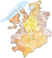
 Karte Gemeinden des Kantons Freiburg 2011.png 2,952 × 3,304; 1.9 MB
-
 Karte Gemeinden des Kantons Freiburg farbig 2011.png 2,952 × 3,304; 2.35 MB
-
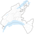
 Karte Gemeinden des Kantons Graubünden 2011.png 3,836 × 2,751; 2.12 MB
-
 Karte Gemeinden des Kantons Graubünden farbig 2011.png 3,836 × 2,751; 2.33 MB
-
 Karte Gemeinden des Kantons Solothurn farbig 2011.png 2,952 × 2,703; 2 MB
-
 Karte Gemeinden des Kantons Waadt 2009.png 2,952 × 2,923; 1.86 MB
-
 Karte Gemeinden des Kantons Waadt 2011 2.png 2,952 × 2,940; 1.57 MB
-
 Karte Gemeinden des Kantons Waadt 2011.png 2,952 × 2,923; 1.84 MB
-
 Karte Gemeinden des Kantons Waadt farbig 2009.png 2,952 × 2,923; 2.4 MB
-
 Karte Gemeinden des Kantons Waadt farbig 2011 2.png 2,952 × 2,940; 2.15 MB
-
 Karte Gemeinden des Kantons Waadt farbig 2011.png 2,952 × 2,923; 2.32 MB


