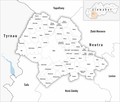
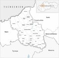
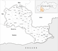
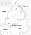
Category:Maps of municipalities of Slovakia
Jump to navigation
Jump to search
Media in category "Maps of municipalities of Slovakia"
The following 79 files are in this category, out of 79 total.
-
Karte Okres Banská Bystrica 2021.png 2,500 × 2,086; 696 KB
-
Karte Okres Banská Štiavnica 2021.png 2,500 × 2,821; 635 KB
-
Karte Okres Bardejov 2021.png 2,500 × 2,306; 923 KB
-
Karte Okres Bratislava I 2021.png 2,500 × 2,851; 613 KB
-
Karte Okres Bratislava II 2021.png 2,500 × 2,851; 660 KB
-
Karte Okres Bratislava III 2021.png 2,500 × 2,851; 641 KB
-
Karte Okres Bratislava IV 2021.png 2,500 × 2,851; 674 KB
-
Karte Okres Bratislava V 2021.png 2,500 × 2,851; 659 KB
-
Karte Okres Brezno 2021.png 2,500 × 1,672; 642 KB
-
Karte Okres Bytča 2021.png 2,500 × 3,224; 645 KB
-
Karte Okres Bánovce nad Bebravou 2021.png 2,500 × 2,418; 841 KB
-
Karte Okres Čadca 2021.png 2,500 × 1,151; 467 KB
-
Karte Okres Detva 2021.png 2,500 × 2,302; 669 KB
-
Karte Okres Dolný Kubín 2021.png 2,500 × 1,848; 608 KB
-
Karte Okres Dunajská Streda 2021.png 2,499 × 2,453; 919 KB
-
Karte Okres Galanta 2021.png 2,500 × 3,057; 987 KB
-
Karte Okres Gelnica 2021.png 2,499 × 2,319; 662 KB
-
Karte Okres Hlohovec 2021.png 2,500 × 2,399; 670 KB
-
Karte Okres Humenné 2021.png 2,500 × 3,051; 961 KB
-
Karte Okres Ilava 2021.png 2,500 × 2,154; 713 KB
-
Karte Okres Kežmarok 2021.png 2,500 × 3,326; 895 KB
-
Karte Okres Komárno 2021.png 2,500 × 1,440; 541 KB
-
Karte Okres Košice I 2021.png 2,500 × 3,514; 665 KB
-
Karte Okres Košice II 2021.png 2,500 × 3,514; 674 KB
-
Karte Okres Košice III 2021.png 2,500 × 3,514; 645 KB
-
Karte Okres Košice IV 2021.png 2,500 × 3,514; 650 KB
-
Karte Okres Košice-okolie 2021.png 2,500 × 2,005; 1.02 MB
-
Karte Okres Krupina 2021.png 2,500 × 2,280; 718 KB
-
Karte Okres Kysucké Nové Mesto 2021.png 2,500 × 2,354; 552 KB
-
Karte Okres Levice 2021.png 2,500 × 2,357; 986 KB
-
Karte Okres Levoča 2021.png 2,500 × 1,936; 600 KB
-
Karte Okres Liptovský Mikuláš 2021.png 2,500 × 2,093; 756 KB
-
Karte Okres Lučenec 2021.png 2,500 × 2,338; 880 KB
-
Karte Okres Malacky 2021.png 2,500 × 2,893; 896 KB
-
Karte Okres Martin 2021.png 2,500 × 2,317; 727 KB
-
Karte Okres Medzilaborce 2021.png 2,500 × 2,825; 671 KB
-
Karte Okres Michalovce 2021.png 2,500 × 3,479; 1.11 MB
-
Karte Okres Myjava 2021.png 2,500 × 2,262; 627 KB
-
Karte Okres Nitra 2021.png 2,499 × 2,119; 870 KB
-
Karte Okres Nové Mesto nad Váhom 2021.png 2,500 × 2,472; 779 KB
-
Karte Okres Nové Zámky 2021.png 2,499 × 2,186; 826 KB
-
Karte Okres Námestovo 2021.png 2,500 × 2,420; 681 KB
-
Karte Okres Partizánske 2021.png 2,500 × 2,526; 696 KB
-
Karte Okres Pezinok 2021.png 2,500 × 2,857; 797 KB
-
Karte Okres Piešťany 2021.png 2,500 × 1,901; 626 KB
-
Karte Okres Poltár 2021.png 2,500 × 2,843; 685 KB
-
Karte Okres Poprad 2021.png 2,500 × 2,891; 801 KB
-
Karte Okres Považská Bystrica 2021.png 2,500 × 3,378; 831 KB
-
Karte Okres Prešov 2021.png 2,500 × 2,347; 1,000 KB
-
Karte Okres Prievidza 2021.png 2,500 × 2,952; 1,019 KB
-
Karte Okres Púchov 2021.png 2,500 × 3,456; 812 KB
-
Karte Okres Revúca 2021.png 2,500 × 2,503; 775 KB
-
Karte Okres Rimavská Sobota 2021.png 2,500 × 3,241; 1.11 MB
-
Karte Okres Rožňava 2021.png 2,500 × 2,903; 895 KB
-
Karte Okres Ružomberok 2021.png 2,500 × 2,654; 678 KB
-
Karte Okres Sabinov 2021.png 2,500 × 1,497; 596 KB
-
Karte Okres Šaľa 2021.png 2,500 × 3,626; 754 KB
-
Karte Okres Senec 2021.png 2,500 × 3,307; 1.02 MB
-
Karte Okres Senica 2021.png 2,500 × 2,066; 711 KB
-
Karte Okres Skalica 2021.png 2,500 × 2,019; 568 KB
-
Karte Okres Snina 2021.png 2,500 × 2,576; 691 KB
-
Karte Okres Sobrance 2021.png 2,500 × 3,421; 889 KB
-
Karte Okres Spišská Nová Ves 2021.png 2,500 × 1,495; 560 KB
-
Karte Okres Stará Ľubovňa 2021.png 2,500 × 1,767; 625 KB
-
Karte Okres Stropkov 2021.png 2,500 × 4,059; 974 KB
-
Karte Okres Svidník 2021.png 2,500 × 3,043; 1,005 KB
-
Karte Okres Topoľčany 2021.png 2,500 × 2,502; 820 KB
-
Karte Okres Trebišov 2021.png 2,500 × 2,294; 934 KB
-
Karte Okres Trenčín 2021.png 2,500 × 2,058; 796 KB
-
Karte Okres Trnava 2021.png 2,500 × 3,045; 1,007 KB
-
Karte Okres Turčianske Teplice 2021.png 2,500 × 2,349; 584 KB
-
Karte Okres Tvrdošín 2021.png 2,500 × 2,405; 615 KB
-
Karte Okres Veľký Krtíš 2021.png 2,500 × 2,407; 900 KB
-
Karte Okres Vranov nad Topľou 2021.png 2,500 × 2,735; 973 KB
-
Karte Okres Žarnovica 2021.png 2,500 × 2,783; 659 KB
-
Karte Okres Žiar nad Hronom 2021.png 2,500 × 2,621; 763 KB
-
Karte Okres Žilina 2021.png 2,500 × 2,399; 893 KB
-
Karte Okres Zlaté Moravce 2021.png 2,500 × 2,386; 731 KB
-
Karte Okres Zvolen 2021.png 2,500 × 2,611; 791 KB


