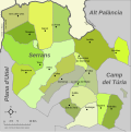
Category:Maps of municipalities of Los Serranos
Jump to navigation
Jump to search
Subcategories
This category has the following 22 subcategories, out of 22 total.
A
- Maps of Alcublas (9 F)
- Maps of Alpuente (5 F)
- Maps of Andilla (8 F)
B
- Maps of Benagéber (7 F)
- Maps of Bugarra (6 F)
C
- Maps of Calles (7 F)
- Maps of Chelva (6 F)
- Maps of Chulilla (10 F)
D
- Maps of Domeño (11 F)
G
- Maps of Gestalgar (8 F)
H
- Maps of Higueruelas (6 F)
L
- Maps of Losa del Obispo (7 F)
P
- Maps of Pedralba (11 F)
S
- Maps of Sot de Chera (9 F)
T
- Maps of Titaguas (8 F)
- Maps of Tuéjar (6 F)
V
Y
- Maps of La Yesa (4 F)
Media in category "Maps of municipalities of Los Serranos"
The following 2 files are in this category, out of 2 total.
-
Mapa de los Serranos.svg 599 × 601; 104 KB
-
Eleccions muni 07 Serrans.png 443 × 440; 7 KB

