Category:Maps of municipalities of Horta Nord
Jump to navigation
Jump to search
Subcategories
This category has the following 24 subcategories, out of 24 total.
A
- Maps of Alboraia (19 F)
- Maps of Albuixech (4 F)
- Maps of Almàssera (8 F)
B
- Maps of Burjassot (14 F)
E
- Maps of Emperador (3 F)
F
- Maps of Foios (8 F)
G
- Maps of Godella (8 F)
M
- Maps of Massalfassar (4 F)
- Maps of Massamagrell (4 F)
- Maps of Meliana (8 F)
- Maps of Moncada (6 F)
- Maps of Museros (6 F)
P
- Maps of Paterna (11 F)
- Maps of Puçol (5 F)
R
- Maps of Rafelbunyol (4 F)
- Maps of Rocafort (7 F)
T
- Maps of Tavernes Blanques (10 F)
V
- Maps of Vinalesa (7 F)
Media in category "Maps of municipalities of Horta Nord"
The following 7 files are in this category, out of 7 total.
-
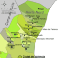
Mapa de l'Horta Nord.png 400 × 400; 52 KB
-
Almàssera, Bonrepòs i Mirambell i àrea.png 1,039 × 539; 189 KB
-
Roca-Cúiper.png 862 × 625; 82 KB
-
Ubicación torres.png 1,262 × 901; 651 KB
-
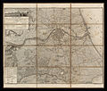
Valencia, València -España- Área; de 1812 -1-.jpg 3,861 × 3,269; 6.28 MB
-
València, etc-Terme 1840.png 2,760 × 2,714; 1.6 MB
-
València, etc-Terme 1840.svg 2,761 × 2,705; 907 KB


