Category:Maps of municipalities in the district of Plessur to 2008
Jump to navigation
Jump to search
Media in category "Maps of municipalities in the district of Plessur to 2008"
The following 15 files are in this category, out of 15 total.
-
 Karte Gemeinde Arosa 2008.png 1,181 × 968; 265 KB
-
 Karte Gemeinde Calfreisen 2008.png 1,181 × 968; 264 KB
-
 Karte Gemeinde Castiel 2008.png 1,181 × 968; 264 KB
-
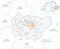
 Karte Gemeinde Chur 2008.png 1,181 × 968; 264 KB
-
 Karte Gemeinde Churwalden 2008.png 1,181 × 968; 266 KB
-
 Karte Gemeinde Langwies 2008.png 1,181 × 968; 266 KB
-
 Karte Gemeinde Lüen 2008.png 1,181 × 968; 264 KB
-
 Karte Gemeinde Maladers 2008.png 1,181 × 968; 264 KB
-
 Karte Gemeinde Malix 2008.png 1,181 × 968; 264 KB
-
 Karte Gemeinde Molinis 2008.png 1,181 × 968; 264 KB
-
 Karte Gemeinde Parpan 2008.png 1,181 × 968; 265 KB
-
 Karte Gemeinde Peist 2008.png 1,181 × 968; 265 KB
-
 Karte Gemeinde Praden 2008.png 1,181 × 968; 264 KB
-
 Karte Gemeinde St. Peter-Pagig 2008.png 1,181 × 968; 265 KB
-
 Karte Gemeinde Tschiertschen 2008.png 1,181 × 968; 265 KB


