Category:Maps of municipalities in the district of Frauenfeld
Jump to navigation
Jump to search
Subcategories
This category has the following 9 subcategories, out of 9 total.
1
Media in category "Maps of municipalities in the district of Frauenfeld"
The following 25 files are in this category, out of 25 total.
-
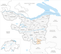
 Karte Gemeinden des Bezirks Frauenfeld 2011.png 1,476 × 1,316; 585 KB
-
 Karte Gemeinde Basadingen-Schlattingen 2011.png 1,476 × 1,316; 586 KB
-
 Karte Gemeinde Berlingen 2011.png 1,476 × 1,316; 585 KB
-
 Carte-évasion-Cioma-Schönhaus.jpg 848 × 1,018; 153 KB
-
 Karte Gemeinde Diessenhofen 2011.png 1,476 × 1,316; 585 KB
-
 Karte Gemeinde Eschenz 2011.png 1,476 × 1,316; 586 KB
-
 Karte Gemeinde Felben-Wellhausen 2011.png 1,476 × 1,316; 586 KB
-
 Karte Gemeinde Frauenfeld 2011.png 1,476 × 1,316; 587 KB
-
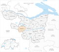
 Karte Gemeinde Gachnang 2011.png 1,476 × 1,316; 586 KB
-
 Karte Gemeinde Herdern 2011.png 1,476 × 1,316; 586 KB
-
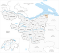
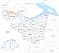
 Karte Gemeinde Homburg 2011.png 1,476 × 1,316; 586 KB
-
 Karte Gemeinde Hüttlingen 2011.png 1,476 × 1,316; 586 KB
-
 Karte Gemeinde Hüttwilen 2011.png 1,476 × 1,316; 586 KB
-
 Karte Gemeinde Mammern 2011.png 1,476 × 1,316; 585 KB
-
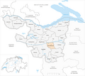
 Karte Gemeinde Matzingen 2011.png 1,476 × 1,316; 586 KB
-
 Karte Gemeinde Müllheim 2011.png 1,476 × 1,316; 586 KB
-
 Karte Gemeinde Neunforn 2011.png 1,476 × 1,316; 586 KB
-
 Karte Gemeinde Pfyn 2011.png 1,476 × 1,316; 586 KB
-
 Karte Gemeinde Schlatt 2011.png 1,476 × 1,316; 586 KB
-
 Karte Gemeinde Steckborn 2011.png 1,476 × 1,316; 586 KB
-
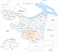
 Karte Gemeinde Stettfurt 2011.png 1,476 × 1,316; 586 KB
-
 Karte Gemeinde Thundorf 2011.png 1,476 × 1,316; 586 KB
-
 Karte Gemeinde Uesslingen-Buch 2011.png 1,476 × 1,316; 587 KB
-
 Karte Gemeinde Wagenhausen 2011.png 1,476 × 1,316; 586 KB
-
 Karte Gemeinde Warth-Weiningen 2011.png 1,476 × 1,316; 586 KB


