Category:Maps of micronations
Jump to navigation
Jump to search
Subcategories
This category has the following 2 subcategories, out of 2 total.
M
W
Media in category "Maps of micronations"
The following 32 files are in this category, out of 32 total.
-
 Aericamap.jpg 936 × 756; 206 KB
-
 AMU Sectioned.png 1,334 × 1,178; 2.15 MB
-
 Balland map.png 742 × 496; 66 KB
-
 Basic map of Florenia.svg 512 × 672; 28 KB
-
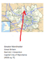
 Britain location EOA.png 881 × 1,477; 91 KB
-
 Croatia Serbia border Backa Baranja.png 520 × 520; 94 KB
-
 Elleore on the Danish map.jpg 587 × 473; 80 KB
-
 F2B.png 695 × 390; 45 KB
-
 Insulo de la Rozoj mapo.jpg 299 × 376; 18 KB
-
 Keig map.png 560 × 599; 63 KB
-
 Location of Myrotania.png 295 × 401; 83 KB
-
 LocationFantomiria.png 1,080 × 1,920; 171 KB
-
 MAP CROZO 2.jpg 300 × 389; 122 KB
-
 Map of Gretigo.jpg 770 × 691; 149 KB
-
 Map of Jusin.png 2,000 × 2,813; 325 KB
-
 Map of Kingdom of Pennylvnd.jpg 430 × 892; 359 KB
-
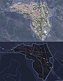
 Map of Republic of Taihsitschen.png 5,335 × 3,335; 355 KB
-
 Map of the Euahlayi People's Republic.png 1,024 × 576; 3 KB
-
 Map of Westarctica.jpg 1,334 × 1,178; 377 KB
-
 Mapa de Parva Domus.png 356 × 589; 28 KB
-
 Mapa de Sudamérica y Saúquinia.svg 578 × 789; 57 KB
-
 Marie Byrd Land in Antarctica.svg 1,200 × 1,200; 919 KB
-
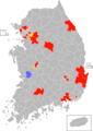
 Micronation Map made by Green Rosie Choi.png 1,564 × 845; 415 KB
-
 Molossia Flag Map.png 720 × 1,280; 24 KB
-
 NZRE WZ boundary.jpg 640 × 478; 133 KB
-
 Other World Kingdom map.png 778 × 474; 460 KB
-
 Pinpointed map of Asarith.png 1,536 × 1,536; 714 KB
-
 Princpality of Ongal КАРТА-а.jpg 801 × 1,020; 325 KB
-
 Sendersia map.png 1,418 × 856; 46 KB
-
 Taihsitsches Reich (orthographic projection).svg 512 × 512; 240 KB
-
 Tavil Republic land in Africa.png 1,200 × 1,107; 185 KB
-
 Territory of The Republic of Slowjamastan.jpg 498 × 323; 107 KB


.svg)

