Category:Maps of local municipalities of the Northern Cape
Jump to navigation
Jump to search
Media in category "Maps of local municipalities of the Northern Cape"
The following 31 files are in this category, out of 31 total.
-
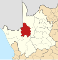
Map of the Northern Cape with Dawid Kruiper highlighted (2016).svg 750 × 764; 565 KB
-
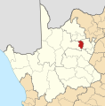
Map of the Northern Cape with Dikgatlong highlighted (2016).svg 750 × 764; 547 KB
-
Map of the Northern Cape with Emthanjeni highlighted (2016).svg 750 × 764; 549 KB
-
Map of the Northern Cape with Ga-Segonyana highlighted (2016).svg 750 × 764; 544 KB
-
Map of the Northern Cape with Gamagara highlighted (2016).svg 750 × 764; 542 KB
-
Map of the Northern Cape with Hantam highlighted (2016).svg 750 × 764; 563 KB
-
Map of the Northern Cape with Joe Morolong highlighted (2016).svg 750 × 764; 553 KB
-
Map of the Northern Cape with Kai !Garib highlighted (2016).svg 750 × 764; 552 KB
-
Map of the Northern Cape with Kamiesberg highlighted (2011).svg 750 × 764; 395 KB
-
Map of the Northern Cape with Kamiesberg highlighted (2016).svg 750 × 764; 555 KB
-
Map of the Northern Cape with Kareeberg highlighted (2011).svg 750 × 764; 391 KB
-
Map of the Northern Cape with Kareeberg highlighted (2016).svg 750 × 764; 550 KB
-
Map of the Northern Cape with Karoo Hoogland highlighted (2011).svg 750 × 764; 399 KB
-
Map of the Northern Cape with Karoo Hoogland highlighted (2016).svg 750 × 764; 560 KB
-
Map of the Northern Cape with Kgatelopele highlighted (2011).svg 750 × 764; 387 KB
-
Map of the Northern Cape with Kgatelopele highlighted (2016).svg 750 × 764; 543 KB
-
Map of the Northern Cape with !Kheis highlighted (2016).svg 750 × 764; 554 KB
-
Map of the Northern Cape with Khâi-Ma highlighted (2016).svg 750 × 764; 551 KB
-
Map of the Northern Cape with Magareng highlighted (2016).svg 750 × 764; 545 KB
-
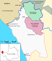
Map Richtersveld Municipality and Parks de.svg 585 × 680; 58 KB
-
Map of the Northern Cape with Nama Khoi highlighted (2016).svg 750 × 764; 554 KB
-
Map of the Northern Cape with Phokwane highlighted (2016).svg 750 × 764; 543 KB
-
Map of the Northern Cape with Renosterberg highlighted (2016).svg 750 × 764; 547 KB
-
Map of the Northern Cape with Richtersveld highlighted (2016).svg 750 × 764; 555 KB
-
Map of the Northern Cape with Siyancuma highlighted (2016).svg 750 × 764; 564 KB
-
Map of the Northern Cape with Siyathemba highlighted (2016).svg 750 × 764; 555 KB
-
Map of the Northern Cape with Sol Plaatje highlighted (2016).svg 750 × 764; 547 KB
-
Map of the Northern Cape with Thembelihle highlighted (2016).svg 750 × 764; 550 KB
-
Map of the Northern Cape with Tsantsabane highlighted (2016).svg 750 × 764; 550 KB
-
Map of the Northern Cape with Ubuntu highlighted (2016).svg 750 × 764; 550 KB
-
Map of the Northern Cape with Umsobomvu highlighted (2016).svg 750 × 764; 549 KB


