Category:Maps of local government areas in Geelong
Jump to navigation
Jump to search
Media in category "Maps of local government areas in Geelong"
The following 10 files are in this category, out of 10 total.
-
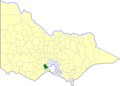
 Australia Victoria Greater Geelong City location map.svg 534 × 638; 510 KB
-
 Australia Victoria Greater Geelong City.svg 1,375 × 967; 313 KB
-
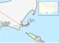 Australia Victoria Queenscliffe Borough location map.svg 533 × 388; 393 KB
-
 Australia Victoria Queenscliffe Borough.svg 1,375 × 967; 313 KB
-
 Australia-Map-VIC-LGA-Greater Geelong.png 550 × 400; 8 KB
-
 Australia-Map-VIC-LGA-Queenscliffe.png 550 × 400; 8 KB
-
 Old lga Bellarine.png 250 × 179; 21 KB
-
 Old lga Corio.png 250 × 179; 21 KB
-
 Old lgadot Geelong.png 250 × 179; 21 KB
-
 Old lgadot South Barwon.png 250 × 179; 21 KB


