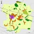
Category:Maps of land use in Saint-Cyr-sur-Menthon
Jump to navigation
Jump to search
Media in category "Maps of land use in Saint-Cyr-sur-Menthon"
The following 3 files are in this category, out of 3 total.
-
01343-Saint-Cyr-sur-Menthon-Sols.png 3,270 × 2,598; 2.25 MB
-
Carte PLU Simplifiée 2016 Saint-Cyr-sur-Menthon Avec Nom.svg 1,500 × 1,500; 160 KB
-
Carte PLU Simplifiée 2016 Saint-Cyr-sur-Menthon.svg 1,500 × 1,500; 132 KB


