Category:Maps of lakes of the United States
Jump to navigation
Jump to search
Subcategories
This category has the following 11 subcategories, out of 11 total.
B
F
- Maps of lakes of Florida (4 F)
G
M
- Maps of lakes of Indiana (9 F)
N
S
- Maps of the Salton Sea (13 F)
Media in category "Maps of lakes of the United States"
The following 36 files are in this category, out of 36 total.
-
1928 Okeechobee Flood.png 855 × 819; 172 KB
-
245 of 'Eclectic Physical Geography' (11291566116).jpg 1,315 × 1,130; 390 KB
-
344 of 'Elementary Physical Geography' (11138722843).jpg 947 × 713; 183 KB
-
Berlin Lake LOC 99441577.jpg 7,724 × 4,325; 3.47 MB
-
Berlin Lake LOC 99441577.tif 7,724 × 4,325; 95.58 MB
-
Blue Water Michigan Map.jpg 119 × 164; 30 KB
-
Cherry Lake Stanislaus National Forest USGS TOPO Map.jpg 512 × 384; 45 KB
-
California fish and game (19890598804).jpg 1,976 × 3,296; 484 KB
-
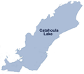
Catahoula Lake.png 914 × 800; 121 KB
-
Glacial lakes in Montana.jpg 745 × 470; 228 KB
-
Green Lake drawing.jpg 316 × 522; 68 KB
-
Green Lake.png 615 × 442; 28 KB
-
Hills Creek Reservoir map.jpg 572 × 395; 68 KB
-
Honey Lake Basin-01.png 3,008 × 2,508; 6.5 MB
-
Kansas Lakes -- Bureau of Reclamation.gif 550 × 261; 23 KB
-
Lake Peigneur.jpg 479 × 530; 95 KB
-
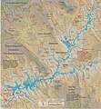
Lake Powell Map.jpg 2,534 × 2,733; 1.42 MB
-
Lake Powell Map.pdf 1,275 × 1,379; 1.52 MB
-
Lake Valdez (Now Lake Monroe) Florida 1826.jpg 1,404 × 837; 542 KB
-
Lake Weatherford boardwalk map.jpg 4,624 × 3,468; 4 MB
-
LakeGeorge layout.jpg 1,600 × 1,200; 125 KB
-
Lakes of Minneapolis map.svg 379 × 612; 54 KB
-
Lewis Lake, Wyoming - OSM.png 1,169 × 826; 378 KB
-
Map of the San Joaquin, Sacramento and Tulare Valleys 1873 - Tulare Valley.jpg 2,384 × 1,885; 2.3 MB
-
LakeMinnetonkaBlue.jpg 441 × 334; 34 KB
-
Montana rivers and lakes.jpg 745 × 470; 168 KB
-
Lake Namakagon.png 668 × 518; 18 KB
-
National-atlas-usa-rivers-unlabeled.png 758 × 584; 171 KB
-
RRBP-Recreation-Map-web.jpg 3,000 × 2,015; 782 KB
-
Southern oregon cascades map.gif 1,186 × 1,114; 97 KB
-
Southern oregon cascades map.png 593 × 557; 24 KB
-
TulareBasinMap.jpg 4,167 × 4,167; 16.33 MB
-
Tulare Lake 1874 cropped.jpg 589 × 838; 391 KB
-
Tulare Lake 1874.jpg 603 × 1,027; 199 KB
-
Waldo Lake map.gif 520 × 685; 180 KB
-
Warm Springs Reservoir Map.png 1,075 × 2,262; 801 KB


