Category:Maps of historic districts on the National Register of Historic Places
Jump to navigation
Jump to search
Subcategories
This category has only the following subcategory.
Media in category "Maps of historic districts on the National Register of Historic Places"
The following 8 files are in this category, out of 8 total.
-
 Blagden Alley-Naylor Court Historic District map.png 398 × 367; 93 KB
-
 Fifteenth Street Financial Historic District map.jpg 478 × 846; 142 KB
-
 Grant Road Historic District map.png 469 × 540; 186 KB
-
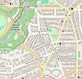 Kalorama Triangle map.jpg 525 × 508; 62 KB
-
 La Grange North Carolina historic district map.jpg 963 × 624; 152 KB
-
 Mount Vernon Triangle Historic District map.png 696 × 424; 113 KB
-
 Sixteenth Street Historic District map.png 406 × 586; 265 KB
-
 Strivers' Section Historic District map.png 673 × 577; 344 KB


