Category:Maps of governorates of the Palestinian territories
Jump to navigation
Jump to search
Subcategories
This category has the following 2 subcategories, out of 2 total.
Media in category "Maps of governorates of the Palestinian territories"
The following 31 files are in this category, out of 31 total.
-
Gaza Strip governorates.png 394 × 533; 15 KB
-
GazaStripGovernatesNonLabeled.svg 222 × 420; 5 KB
-
Pa gov gaza.png 756 × 880; 12 KB
-
Pa gov jenine.png 756 × 880; 12 KB
-
Pa gov jerusalem.png 756 × 880; 12 KB
-
Pa gov khan yunis.png 756 × 880; 12 KB
-
Khan Younis, Gaza Strip.svg 190 × 234; 5 KB
-
Pa gov bethlehem.png 756 × 880; 12 KB
-
Pa gov deir al-balah.png 756 × 880; 12 KB
-
Pa gov hebron.png 756 × 880; 12 KB
-
Pa gov jericho.png 756 × 880; 12 KB
-
Pa gov nablus.png 756 × 880; 12 KB
-
Pa gov north gaza.png 756 × 880; 12 KB
-
Pa gov qalqilia.png 756 × 880; 12 KB
-
Pa gov rafah.png 756 × 880; 12 KB
-
Pa gov ramallah el-beireh.png 756 × 880; 12 KB
-
Pa gov salfeit.png 756 × 880; 12 KB
-
Pa gov toulkarem.png 756 × 880; 12 KB
-
Pa gov tubas.png 756 × 880; 12 KB
-
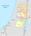
Palestine (-claimed), administrative divisions - mk - colored.svg 639 × 736; 300 KB
-
Palestine Base Map.png 1,101 × 699; 249 KB
-
Palestine election map-ar.png 1,115 × 1,530; 192 KB
-
Palestine election map.PNG 1,115 × 1,530; 106 KB
-
Palestine governorates-he.svg 779 × 902; 75 KB
-
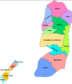
Palestine governorates.png 755 × 878; 23 KB
-
Palestinian legislative election 2006.png 756 × 880; 30 KB
-
West bank and Gaza Governotates.jpg 891 × 952; 69 KB
-
Westbankgovernates.svg 380 × 734; 1.89 MB
-
WestBankGovernatesNonLabeled-2.png 297 × 600; 52 KB
-
WestBankGovernatesNonLabeled.png 648 × 1,308; 101 KB
-
Westbankgovernatesnonlabeled.svg 359 × 734; 1.75 MB


