Category:Maps of glacial geomorphology
Jump to navigation
Jump to search
Subcategories
This category has the following 2 subcategories, out of 2 total.
M
- Maps of glacial erosion (3 F)
Media in category "Maps of glacial geomorphology"
The following 13 files are in this category, out of 13 total.
-
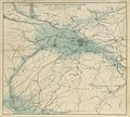
196 of '(The Great Ice Age and its relation to the antiquity of man.)' (11119456273).jpg 2,400 × 2,151; 1.11 MB
-
523 of '(The Great Ice Age and its relation to the antiquity of man.)' (11119972596).jpg 2,757 × 2,413; 1.29 MB
-
AncientLakeAtna.gif 3,108 × 2,384; 4.49 MB
-
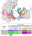
Circum-Arctic Map of Permafrost and Ground Ice Conditions.png 683 × 766; 29 KB
-
Drumlinfield large.jpg 700 × 947; 161 KB
-
Glacial lakes.jpg 750 × 545; 114 KB
-
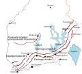
Map of Salpausselka and other end-morain ridges in Finland rus.svg 600 × 539; 87 KB
-
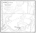
PSM V38 D763 Ancient channel of the ohio river around cincinnati.jpg 1,843 × 1,674; 338 KB
-
PSM V38 D764 Effect of the glacial dam at cincinnati.jpg 2,556 × 1,546; 412 KB
-
Salpausselat-kartta.svg 600 × 539; 88 KB
-
Taylor County glacial map.gif 630 × 358; 37 KB
-
Zoneofpalsas.jpg 406 × 479; 71 KB
-
Ősfolyamvölgy.PNG 935 × 483; 21 KB


