Category:Maps of fortifications in Portugal
Jump to navigation
Jump to search
Media in category "Maps of fortifications in Portugal"
The following 21 files are in this category, out of 21 total.
-
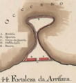 ArrifanaFortress2.png 484 × 526; 454 KB
-
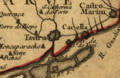
 Engº Sande de Vasconcelos - Planta do Fortaleza de Cacela.png 784 × 296; 315 KB
-
 Forte do Burgau - Jose de Sande Vasconcelos.png 1,344 × 599; 3.08 MB
-
 Forte em Mapa de 1700.png 306 × 198; 151 KB
-
 Gravura das muralhas de Lagos no Seculo XVI (A) - Arquivo Militar Sueco.jpg 15,640 × 8,699; 9.61 MB
-
 Gravura das muralhas de Lagos no Seculo XVI (B) - Arquivo Militar Sueco.jpg 15,640 × 8,728; 9.24 MB
-
 Manesson-Travaux-de-Mars 9591.tif 3,312 × 5,264; 49.91 MB
-
 Manesson-Travaux-de-Mars 9627.tif 3,432 × 5,448; 53.53 MB
-
 Manesson-Travaux-de-Mars 9669.tif 3,472 × 5,408; 53.75 MB
-
 Manesson-Travaux-de-Mars 9670.tif 3,456 × 5,376; 53.19 MB
-
 Manesson-Travaux-de-Mars 9676.tif 3,448 × 5,328; 52.59 MB
-
 Manesson-Travaux-de-Mars 9685.tif 3,416 × 5,200; 50.86 MB
-
 Manesson-Travaux-de-Mars 9686.tif 3,496 × 5,304; 53.09 MB
-
 Mapa do Castelo de Cola por Manuel do Cenaculo.jpg 2,278 × 1,535; 2.06 MB
-

-
 Planta da Fortaleza de Villa Nova de Milfontes.jpg 3,672 × 2,858; 1.46 MB
-
 Planta de Lagos no seculo XVII - Torre do Tombo.png 1,254 × 1,899; 9.11 MB
-
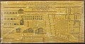
 Planta do andar superior do quartel para o Regimento de Artilharia de Faro.jpg 5,000 × 4,923; 15.45 MB
-
 Planta do Forte da Meia Praia no Seculo XVIII.jpg 3,400 × 2,022; 6.61 MB
-
 Planta do Forte da Ponta da Bandeira no Seculo XVIII.jpg 3,227 × 1,848; 5.49 MB
-
 Planta do Trem de Artilharia de Lagos em 1794.jpg 7,328 × 3,780; 23.41 MB


_-_Arquivo_Militar_Sueco.jpg)
_-_Arquivo_Militar_Sueco.jpg)


