Category:Maps of fortifications
Jump to navigation
Jump to search
Subcategories
This category has the following 8 subcategories, out of 8 total.
Media in category "Maps of fortifications"
The following 139 files are in this category, out of 139 total.
-
106 of 'History of the Indian Tribes of Hudson's River, etc' (11247290273).jpg 1,251 × 1,066; 378 KB
-
FestungPhilippsburg1.jpg 1,200 × 1,013; 445 KB
-
Fotothek df tg 0002920 Architektur ^ Festungsbau.jpg 619 × 820; 268 KB
-
A plan of the city of Pellacata with its Castle Wellcome L0038176.jpg 3,966 × 3,120; 5.2 MB
-
Ana-fortfisher-2006.gif 452 × 522; 227 KB
-
Anfahrt Zitadelle.jpg 1,654 × 1,169; 267 KB
-
Antwerpen 1708-45 Baillieul.JPG 4,199 × 3,207; 12.4 MB
-
Bely gorod на карте Москвы Меттеуса Мериана.jpg 796 × 626; 268 KB
-
Bitwa o Nowogrod.png 1,760 × 900; 1.21 MB
-
Bohus1645 cropped.jpg 1,727 × 1,523; 774 KB
-
Bredevoort1600.jpg 446 × 526; 49 KB
-
Brockhaus and Efron Encyclopedic Dictionary b32 900-0.jpg 3,393 × 2,552; 1.59 MB
-
Brockhaus and Efron Encyclopedic Dictionary b35 250-0.jpg 411 × 206; 29 KB
-
Cyriaksburg-1870-k.jpg 1,000 × 824; 828 KB
-
De Merian Mainz Trier Köln 060.jpg 4,200 × 3,348; 2.17 MB
-
Die Gartenlaube (1870) b 736.jpg 2,326 × 1,559; 340 KB
-
Dùn an Achaidh (OS map, 1881).jpg 749 × 618; 210 KB
-
Erfurt Petersberg 1730.jpg 2,100 × 1,491; 2.16 MB
-
Exagono - Fortificado pello Sistema de Vauban.jpg 2,514 × 2,152; 1.31 MB
-
Famagusta fortifications map.png 2,232 × 1,676; 84 KB
-
Feste boyen map.jpg 2,048 × 1,536; 664 KB
-
Festung Ingolstadt 1500.jpg 300 × 251; 32 KB
-
Festung Ingolstadt 1573.jpg 800 × 539; 191 KB
-
Festung Ingolstadt 1800.jpg 322 × 250; 30 KB
-
Festung Kehl 1788.jpg 848 × 832; 541 KB
-
Festung Rothenberg Lageplan 2008.JPG 2,048 × 1,536; 632 KB
-
Festung Ulm.jpg 913 × 759; 124 KB
-
Figura 1 Reducto.png 479 × 403; 298 KB
-
Fort Detroit and flanking ribbon farms.tif 824 × 576; 528 KB
-
Fort Ligonier.jpg 1,077 × 765; 91 KB
-
Fort Nassau of De Voorn (Heerewaarden).jpg 3,296 × 2,601; 2.22 MB
-
Fort Navagne, ca 1674 (GAM nr 1570).jpg 900 × 644; 192 KB
-
Fort Pickens (13147918664).jpg 2,853 × 2,629; 2.07 MB
-
Fort Pickens map 1861.png 2,349 × 2,181; 3.45 MB
-
Fort Royal en 1775.jpg 860 × 799; 191 KB
-
Forte tombion piantina.jpg 424 × 288; 111 KB
-
Forteresse urartéenne artaxata.jpg 2,480 × 1,886; 264 KB
-
Fortezza Rethymno map.png 2,368 × 1,976; 268 KB
-
Fortezza Rethymnon schematic map.jpg 1,495 × 1,079; 58 KB
-
Fortification gravure. legendee.jpeg 805 × 460; 166 KB
-
Fortifications after Raid on Lorient 1746 map-fr.svg 1,190 × 793; 823 KB
-
Fortifications aux Antilles Guadeloupe, Lacour T2, p242.jpg 780 × 1,082; 183 KB
-
Fortifikationskarta vid Gendt, 1644 - Skoklosters slott - 99062.tif 5,226 × 2,179, 2 pages; 32.6 MB
-
Fortifikationskarta över Charleroy,1709 - Skoklosters slott - 99059.tif 4,726 × 3,389, 2 pages; 45.85 MB
-
Fortifikationskarta över Mannheim., 1622 - Skoklosters slott - 99057.tif 5,041 × 3,484, 2 pages; 50.27 MB
-
Fortifikationskarta över staden Perpignan, 1642 - Skoklosters slott - 99056.tif 4,572 × 3,644, 2 pages; 47.69 MB
-
Fortifikationskartor - Skoklosters slott - 99048.tif 4,532 × 3,394, 2 pages; 44.03 MB
-
Forty Piątnica.png 1,400 × 1,479; 1.45 MB
-
Fotothek df tg 0002921 Architektur ^ Festungsbau.jpg 660 × 800; 271 KB
-
Ft. Oberer Eselsberg.jpg 3,000 × 2,998; 2.12 MB
-
Greifswald im Mittelalter (Rekonstruktion Theodor Pyl).jpg 2,175 × 950; 981 KB
-
Grolla - Map of Groenlo, after 1628 (J.Blaeu, 1649).jpg 5,500 × 4,211; 2.7 MB
-
Groningen (afbeeldinge der stadt Groningen met omliggende fortressen) - Haubois, 1652.jpg 3,000 × 2,493; 2.11 MB
-
GrundrissPlassenburg1929.JPG 320 × 220; 26 KB
-
GrundrißPetersberg 1868.jpg 2,104 × 1,831; 2.5 MB
-
GrundrißPetersberg.jpg 1,791 × 1,289; 1,014 KB
-
Gwaliorfort.png 1,911 × 1,064; 189 KB
-
Gyepű.jpg 414 × 307; 165 KB
-
Hornwerk.png 312 × 319; 104 KB
-
Johann Baptist Homann - Prospect der Churf. Residentz St. Manheim.jpg 4,583 × 3,888; 10.08 MB
-
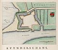
Kaart van de schans van Kuinre (Kuynder-schans).jpg 3,482 × 2,988; 1.26 MB
-
Karnakoski pohjapiirros.png 1,218 × 1,486; 414 KB
-
Karta över fortifikation i Maastricht, försvarssituation med namngivna truppenheter, 1673 - Skoklosters slott - 99052.tif 4,537 × 3,494, 2 pages; 45.38 MB
-
Karta över fortifikationen i Rhin Bergve och Rhees vid Rhen (Tyskland), 1672 - Skoklosters slott - 99051.tif 4,562 × 3,444, 2 pages; 44.98 MB
-
Karte der Festung Rothenberg.png 2,298 × 1,901; 1.13 MB
-
Karte-ko1888.png 2,924 × 2,714; 6.18 MB
-
Ko1700.png 1,654 × 1,398; 1.62 MB
-
Kondurcha.png 3,732 × 2,354; 751 KB
-
Lageplan ZitadelleCyriaksburg.jpg 3,508 × 2,480; 2.56 MB
-
Landpoort.jpg 512 × 705; 50 KB
-
Langemarck-Kaserne 1.jpg 1,500 × 1,006; 115 KB
-
Linia Mołotowa - Punkt Oporu Lesko.png 1,022 × 1,200; 1.24 MB
-
Linia Mołotowa - Punkt Oporu Niedźwiadna.png 1,200 × 853; 664 KB
-
Luxembourgmap.jpg 610 × 505; 410 KB
-
Mainz um 1844 lehnhardt.jpg 1,318 × 995; 773 KB
-
Mannheim 1722.jpg 1,448 × 1,982; 587 KB
-
Mannheim 1725 von M.jpg 1,741 × 1,472; 1.4 MB
-
Mannheim 1735.jpg 1,158 × 924; 434 KB
-
Manual of military engineering (1905) (14595887608).jpg 3,152 × 1,912; 436 KB
-
Map de berlin 1710.jpg 2,244 × 1,710; 1.47 MB
-
Matthäus Seutter - Prospect der Chur Fürst. Haupt und Residenz Statt Manheim.jpg 4,595 × 3,954; 10.44 MB
-
Mauer von Derbend.jpg 1,382 × 1,105; 307 KB
-
Meyers b6 s0189a.jpg 3,416 × 5,188; 1.89 MB
-
Mémoires d'artillerie Surirey 78419.jpg 4,108 × 1,975; 1.73 MB
-
Mémoires d'artillerie Surirey 78420.jpg 4,108 × 2,052; 2.2 MB
-
Mémoires d'artillerie Surirey 79049.jpg 3,899 × 1,743; 2.02 MB
-
Mémoires d'artillerie Surirey 80011.jpg 3,811 × 2,657; 2.19 MB
-
Mémoires d'artillerie Surirey 80020.jpg 2,019 × 2,656; 948 KB
-
Mémoires d'artillerie Surirey 80314.jpg 2,557 × 3,938; 2.5 MB
-
Möglig fortifikationskarta över Fribourg, 1700-tal - Skoklosters slott - 99061.tif 4,312 × 3,434, 2 pages; 42.39 MB
-
Neuitalienische Manier.png 366 × 179; 27 KB
-
Oczakow 1787 mapa.jpg 1,024 × 777; 162 KB
-
Oczakow belagerung 1788.jpg 898 × 572; 104 KB
-
Ofen BODENEHR, GABRIEL (1664-1758). FORCE D'EUROPE.JPG 1,726 × 1,068; 1.14 MB
-
OldMapofSaarlouis.gif 1,869 × 1,464; 1.08 MB
-
Orsoy 1650-4.png 729 × 585; 381 KB
-
Pianta Forte Roncogno.jpg 738 × 676; 87 KB
-
Plan actuel forteresse.jpg 2,043 × 866; 181 KB
-
Plan des remparts de Vitré.png 1,030 × 587; 298 KB
-
Plan du fort françois de Whidah-1747.jpg 512 × 679; 70 KB
-
Plan Fort Barrancas.png 952 × 604; 196 KB
-
Plan Fort Pulaski.PNG 800 × 508; 553 KB
-
Plan och profil till befästning vid Skoklosters slott, 1700 cirka - Skoklosters slott - 99028.tif 5,062 × 3,239, 2 pages; 46.93 MB
-
Plan och profil till befästning vid Skoklosters slott, 1700 cirka - Skoklosters slott - 99030.tif 4,996 × 3,294, 2 pages; 47.11 MB
-
Plan Verle Kopie.png 2,500 × 2,466; 1.22 MB
-
Plan Veste CO 1553.png 2,788 × 1,750; 293 KB
-
Plan Veste CO 1625.png 2,788 × 1,750; 323 KB
-
Plan Veste CO 2005.png 2,788 × 1,750; 804 KB
-
Plan Werk Gschwendt.png 2,814 × 2,236; 2.77 MB
-
Plan Werk Nago.png 750 × 734; 1,023 KB
-
Plan Werk Tonale.png 1,200 × 1,127; 1.46 MB
-
Plan över fästning - Skoklosters slott - 98084.tif 4,690 × 3,111; 41.76 MB
-
Plan över fästning på ö i flodkrök - Skoklosters slott - 98081.tif 4,446 × 3,653, 2 pages; 46.48 MB
-
Posten Vezzena.png 1,000 × 667; 535 KB
-
Przebieg Linii Mołotowa.jpg 1,200 × 900; 274 KB
-
Rhodes-sketchFortifications.jpg 738 × 663; 251 KB
-
Schandorf - Information board for Tumulis in Bauernwald (11).jpg 1,200 × 1,500; 399 KB
-
Schanze Grf Alexander.jpg 2,500 × 1,836; 438 KB
-
Spandau Zitadelle.png 1,686 × 1,497; 481 KB
-
Sperre Rocchetta.png 800 × 522; 1,014 KB
-
St Roman - Schanze (Johann Ev Lamprecht, Archäologische Streifzüge OÖLA).jpg 907 × 2,342; 414 KB
-
Stadt Mannheim-1740 M-Seutter.jpg 2,000 × 1,735; 1.02 MB
-
Svartholma kartta.png 1,312 × 880; 239 KB
-
System Feste Franz.JPG 2,498 × 1,845; 2.93 MB
-
Taganrog Fortress1698.jpg 797 × 681; 155 KB
-
Twierdza Łomża.png 1,272 × 1,200; 1.15 MB
-
Vestingtermen.svg 800 × 498; 75 KB
-
Viipurin kaupunginmuurin pohjapiirros 1750.png 1,193 × 967; 185 KB
-
Werk Sebastiano.png 2,000 × 1,655; 3.52 MB
-
ZitadelleCyriaksburg Verstärkungsplan.jpg 764 × 1,109; 448 KB
-
ZLB-Berliner Ansichten-Januar.jpg 4,961 × 3,390; 3.23 MB
-
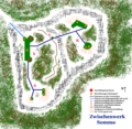
Zwischenwerk Sommo.png 1,200 × 1,172; 2.1 MB
-
Линия "Диль".jpg 1,378 × 894; 252 KB


