Category:Maps of former provinces of Ethiopia
Jump to navigation
Jump to search
Subcategories
This category has the following 4 subcategories, out of 4 total.
Media in category "Maps of former provinces of Ethiopia"
The following 20 files are in this category, out of 20 total.
-
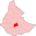
Arsi Province.png 602 × 478; 72 KB
-
ArsiProvince.png 602 × 478; 48 KB
-
Damot province map.jpg 828 × 1,255; 1.03 MB
-
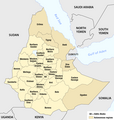
Ethiop-adm-1987-ru.png 1,486 × 1,149; 44 KB
-
Ethiopia - Administrative regions 1987-1991.png 1,266 × 1,332; 203 KB
-
Ethiopia Map 1963 - 1987.png 730 × 434; 14 KB
-
Ethiopia, administrative divisions - en - colored (1943-1987).svg 1,843 × 1,862; 807 KB
-
Ethiopia, administrative divisions - en - colored (1991-1995).svg 1,843 × 1,494; 575 KB
-
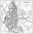
Ethiopia1911.png 2,004 × 2,066; 3.06 MB
-
Ethiopian Provinces.png 602 × 600; 74 KB
-
EthiopianProvinces.png 602 × 478; 73 KB
-
Karte Verwaltungsgliederung Äthiopien 1987-1991.png 1,266 × 1,332; 203 KB
-
Map of Eritrea Province.png 739 × 738; 142 KB
-
MedievalEthiopia.png 1,028 × 1,026; 451 KB
-
Provinces Arsi.png 899 × 896; 88 KB
-
Provinces Ethiopie.png 899 × 896; 106 KB
-
Provinces of Ethiopia, before 1935.svg 932 × 728; 483 KB
-
Provinces of Ethiopia.png 602 × 478; 74 KB
-
Un-ethiopia.png 3,038 × 2,257; 1.6 MB
-
Административное деление Эфиопии 1987-1991.png 1,266 × 1,332; 162 KB


