Category:Maps of forests in Hautes-Alpes
Jump to navigation
Jump to search
Departments of Metropolitan France: Ain [01] · Aisne [02] · Allier [03] · Alpes-de-Haute-Provence [04] · Hautes-Alpes [05] · Alpes-Maritimes [06] · Ardèche [07] · Ardennes [08] · Ariège [09] · Aube [10] · Aude [11] · Aveyron [12] · Bouches-du-Rhône [13] · Calvados [14] · Cantal [15] · Charente [16] · Charente-Maritime [17] · Cher [18] · Corrèze [19] · Corse-du-Sud [2A]† · Haute-Corse [2B]† · Côte-d’Or [21] · Côtes-d'Armor [22] · Creuse [23] · Dordogne [24] · Doubs [25] · Drôme [26] · Eure [27] · Eure-et-Loir [28] · Finistère [29] · Gard [30] · Haute-Garonne [31] · Gers [32] · Gironde [33] · Hérault [34] · Ille-et-Vilaine [35] · Indre [36] · Indre-et-Loire [37] · Isère [38] · Jura [39] · Landes [40] · Loir-et-Cher [41] · Loire [42] · Haute-Loire [43] · Loire-Atlantique [44] · Loiret [45] · Lot [46] · Lot-et-Garonne [47] · Lozère [48] · Maine-et-Loire [49] · Manche [50] · Marne [51] · Haute-Marne [52] · Mayenne [53] · Meurthe-et-Moselle [54] · Meuse [55] · Morbihan [56] · Moselle [57] · Nièvre [58] · Nord [59] · Oise [60] · Orne [61] · Pas-de-Calais [62] · Puy-de-Dôme [63] · Pyrénées-Atlantiques [64] · Hautes-Pyrénées [65] · Pyrénées-Orientales [66] · Bas-Rhin [67] · Haut-Rhin [68] · Rhône [69D]‡ · Haute-Saône [70] · Saône-et-Loire [71] · Sarthe [72] · Savoie [73] · Haute-Savoie [74] · Seine-Maritime [76] · Seine-et-Marne [77] · Yvelines [78] · Deux-Sèvres [79] · Somme [80] · Tarn [81] · Tarn-et-Garonne [82] · Var [83] · Vaucluse [84] · Vendée [85] · Vienne [86] · Haute-Vienne [87] · Vosges [88] · Yonne [89] · Territoire de Belfort [90] · Essonne [91] · Hauts-de-Seine [92] · Seine-Saint-Denis [93] · Val-de-Marne [94] · Val-d'Oise [95]
Subcategories
This category has only the following subcategory.
Media in category "Maps of forests in Hautes-Alpes"
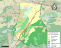
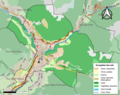
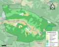
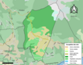
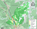
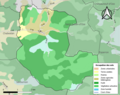
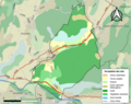
The following 29 files are in this category, out of 29 total.
-
 05001-Abriès-Ristolas-Sols.png 3,270 × 2,598; 1.52 MB
-
 05003-Aiguilles-Sols.png 3,270 × 2,598; 1.24 MB
-
 05011-Avançon-Sols.png 3,270 × 2,598; 1.75 MB
-
 05013-Barcillonnette-Sols.png 3,270 × 2,598; 1.08 MB
-
 05023-Briançon-Sols.png 3,270 × 2,598; 2.57 MB
-
 05024-Valdoule-Sols.png 3,270 × 2,598; 1.34 MB
-
 05026-Ceillac-Sols.png 3,270 × 2,598; 1.36 MB
-
 05033-Chanousse-Sols.png 3,270 × 2,598; 999 KB
-
 05047-Éourres-Sols.png 3,270 × 2,598; 1,022 KB
-
 05051-Étoile-Saint-Cyrice-Sols.png 3,270 × 2,598; 1.02 MB
-
 05055-La Faurie-Sols.png 3,270 × 2,598; 1.21 MB
-
 05060-Furmeyer-Sols.png 3,270 × 2,598; 1.19 MB
-
 05066-La Haute-Beaume-Sols.png 3,270 × 2,598; 768 KB
-
 05086-Montjay-Sols.png 3,270 × 2,598; 1.21 MB
-
 05102-La Piarre-Sols.png 3,270 × 2,598; 938 KB
-
 05108-Puy-Saint-Eusèbe-Sols.png 3,270 × 2,598; 1.37 MB
-
 05109-Puy-Saint-Pierre-Sols.png 3,270 × 2,598; 1.74 MB
-
 05116-Réotier-Sols.png 3,270 × 2,598; 1.31 MB
-
 05117-Ribeyret-Sols.png 3,270 × 2,598; 983 KB
-
 05136-Saint-Crépin-Sols.png 3,270 × 2,598; 1.74 MB
-
 05142-Saint-Firmin-Sols.png 3,270 × 2,598; 1.4 MB
-
 05146-Saint-Julien-en-Beauchêne-Sols.png 3,270 × 2,598; 1.32 MB
-
 05155-Saint-Pierre-Avez-Sols.png 3,270 × 2,598; 825 KB
-
 05157-Saint-Véran-Sols.png 3,270 × 2,598; 1.05 MB
-
 05158-Le Saix-Sols.png 3,270 × 2,598; 1,018 KB
-
 05164-Savines-le-Lac-Sols.png 3,270 × 2,598; 2.2 MB
-
 05176-Valserres-Sols.png 3,270 × 2,598; 1.64 MB
-
 05179-Veynes-Sols.png 3,270 × 2,598; 2.06 MB
-
 05180-Les Vigneaux-Sols.png 3,270 × 2,598; 1.64 MB


