Category:Maps of ethnic groups in China
Jump to navigation
Jump to search
Media in category "Maps of ethnic groups in China"
The following 96 files are in this category, out of 96 total.
-
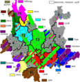
Autonomies in Yunnan.png 454 × 470; 54 KB
-
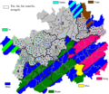
Autonomy territories in Guizhou.png 579 × 500; 64 KB
-
Bai autonomous prefectures and counties in China.png 2,677 × 2,183; 330 KB
-
Baiyue(500bc).jpg 640 × 505; 186 KB
-
Blang autonomous prefectures and counties in China.png 2,677 × 2,183; 329 KB
-
Bonan autonomous prefectures and counties in China.png 2,677 × 2,183; 307 KB
-
Bouyei autonomous prefectures and counties in China.png 2,677 × 2,183; 330 KB
-
Chinese Ethnolinguistic Groups (China) - DPLA - fafd3a280531dbc897250d8bdc062064.jpg 2,554 × 3,276; 3.22 MB
-
Dai autonomous prefectures and counties in China.png 2,677 × 2,183; 330 KB
-
Daur autonomous prefectures and counties in China.png 2,677 × 2,183; 329 KB
-
Derung autonomous prefectures and counties in China.png 2,677 × 2,183; 329 KB
-
Dong autonomous prefectures and counties in China.png 2,677 × 2,183; 329 KB
-
Dongxiang autonomous prefectures and counties in China.png 2,677 × 2,183; 329 KB
-
Ethinic regional map of china.jpg 1,000 × 858; 92 KB
-
Ethnic minorities areas in Guizhou-zh.png 579 × 500; 69 KB
-
Ethnic minorities areas in Guizhou.png 579 × 500; 27 KB
-
Ethnic minorities areas in Yunnan-zh.png 454 × 470; 65 KB
-
Ethnic minorities areas in Yunnan.png 454 × 470; 55 KB
-
Ethnic townships in Bijie.png 752 × 606; 92 KB
-
Ethnic townships in Liupanshui.png 615 × 683; 72 KB
-
Ethnic townships in Sentral Sichuan Yaan and Garze.png 813 × 689; 94 KB
-
Ethnic townships in Sichuan Mianyang.png 541 × 487; 38 KB
-
Ethnic townships in South Sichuan Yibin and Luzhou.png 835 × 515; 86 KB
-
Ethnic townships in South-Eastern Hunan.png 852 × 503; 82 KB
-
Ethnic townships in Yunnan Qujing.png 691 × 685; 82 KB
-
Ethnic townships in Yunnan Zhaotong-Zhenxiong.png 641 × 487; 59 KB
-
Ethnic townships in Yunnan, Sichuan, Guizhou.png 935 × 660; 91 KB
-
Ethnic Yi.png 624 × 732; 50 KB
-
Ethno-linguistic based administrative division map of China.png 2,677 × 2,183; 544 KB
-
Ethno-linguistic based on roughly distribution map of China.png 4,725 × 4,725; 1.15 MB
-
Ethno-linguistic based regions of China.png 2,677 × 2,183; 470 KB
-
Evenk autonomous prefectures and counties in China.png 2,677 × 2,183; 329 KB
-
Gelao autonomous prefectures and counties in China.png 2,677 × 2,183; 329 KB
-
Guangximap03.png 3,000 × 2,041; 463 KB
-
GuangximapRT.png 3,000 × 2,041; 470 KB
-
Hani autonomous prefectures and counties in China.png 2,677 × 2,183; 330 KB
-
Hui autonomous prefectures and counties in China..png 2,677 × 2,183; 332 KB
-
Inner Mongolia County-Level Ethnicity Map (2020 data).svg 6,540 × 5,190; 2.95 MB
-
Jingpo autonomous prefectures and counties in China.png 2,677 × 2,183; 329 KB
-
Kam-Sui autonomous prefectures and counties in China.png 2,677 × 2,183; 330 KB
-
Kam-Sui people.png 1,526 × 926; 157 KB
-
Kazakh autonomous prefectures and counties in China.png 2,677 × 2,183; 332 KB
-
Korean autonomous prefectures and counties in China.png 2,677 × 2,183; 329 KB
-
Kyrgyz autonomous prefectures and counties in China.png 2,677 × 2,183; 329 KB
-
Lahu autonomous prefectures and counties in China.png 2,677 × 2,183; 329 KB
-
Li autonomous prefectures and counties in China.png 2,677 × 2,183; 329 KB
-
Lisu autonomous prefectures and counties in China.png 2,677 × 2,183; 330 KB
-
Manchu autonomous prefectures and counties in China.png 2,677 × 2,183; 330 KB
-
Manchu autonomous regions in Hebei.png 480 × 617; 54 KB
-
Manchu autonomous regions in Jilin.png 606 × 486; 42 KB
-
Manchu autonomous regions in Liaoning.png 503 × 468; 43 KB
-
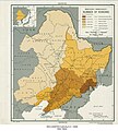
Manchuria "Manchuko" Number of Koreans - DPLA - fd7dad51ca66ec61d78014846c64505a.jpg 4,776 × 5,290; 3.18 MB
-
Maonan autonomous prefectures and counties in China.png 2,677 × 2,183; 329 KB
-
Mapa China.svg 290 × 234; 152 KB
-
Miao autonomous prefectures and counties in China.png 2,677 × 2,183; 332 KB
-
Mongol autonomous prefectures and counties in China.png 2,677 × 2,183; 340 KB
-
Mulao autonomous prefectures and counties in China.png 2,677 × 2,183; 329 KB
-
Nakhi autonomous prefectures and counties in China.png 2,677 × 2,183; 307 KB
-
Nu autonomous prefectures and counties in China.png 2,677 × 2,183; 329 KB
-
Oroqen autonomous prefectures and counties in China.png 2,677 × 2,183; 330 KB
-
Percent of manchu in counties of China.png 1,262 × 645; 72 KB
-
Pourcentage de han.png 6,804 × 4,937; 498 KB
-
Pumi autonomous prefectures and counties in China.png 2,677 × 2,183; 329 KB
-
Qiang autonomous prefectures and counties in China.png 2,677 × 2,183; 330 KB
-
Salar autonomous prefectures and counties in China.png 2,677 × 2,183; 329 KB
-
She autonomous prefectures and counties in China.png 2,677 × 2,183; 329 KB
-
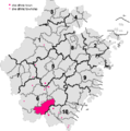
She ethnic county, townships and towns in Zhejiang.png 497 × 500; 44 KB
-
She ethnic townships in Fujian.png 440 × 500; 44 KB
-
She ethnic townships in Jiangxi.png 397 × 500; 39 KB
-
Srovnání rozložení menšin.jpg 1,917 × 873; 217 KB
-
Sui autonomous prefectures and counties in China.png 2,677 × 2,183; 329 KB
-
Tajik autonomous prefectures and counties in China.png 2,677 × 2,183; 329 KB
-
Tibetan autonomous prefectures and counties in China..png 2,677 × 2,183; 337 KB
-
Tibetan distribution in China (1967).svg 2,677 × 2,183; 696 KB
-
TNZB1.png 3,000 × 2,122; 1.21 MB
-
TNZB2.png 3,511 × 2,484; 797 KB
-
TNZM.png 3,000 × 1,904; 318 KB
-
TNZMen.png 3,000 × 1,904; 320 KB
-
Tu autonomous prefectures and counties in China.png 2,677 × 2,183; 329 KB
-
Tujia autonomous prefectures and counties in China.png 2,677 × 2,183; 330 KB
-
Tujia distribution density.png 1,334 × 922; 139 KB
-
Uyghur autonomous prefectures and counties in China..png 2,677 × 2,183; 354 KB
-
Wa autonomous prefectures and counties in China.png 2,677 × 2,183; 329 KB
-
Xibe autonomous prefectures and counties in China.png 2,677 × 2,183; 329 KB
-
Xinjiang County-Level Ethnicity Map (2018 data).svg 6,397 × 3,324; 4.71 MB
-
Xinjiang ethnic group by county 2019.svg 737 × 495; 2.12 MB
-
Xinjiang nationalities by prefecture 2000.png 1,474 × 1,219; 129 KB
-
Yao autonomous prefectures and counties in China.png 2,677 × 2,183; 329 KB
-
Yao distribution China.png 2,328 × 1,344; 269 KB
-
Yi autonomous prefectures and counties in China.png 2,677 × 2,183; 333 KB
-
Yugur autonomous prefectures and counties in China.png 2,677 × 2,183; 329 KB
-
Zhuang And Bouyei Map.png 4,953 × 3,052; 1.87 MB
-
Zhuang autonomous prefectures and counties in China..png 2,677 × 2,183; 333 KB
-
Китай.jpg 1,521 × 1,380; 193 KB
-
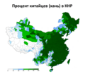
Процент китайцев в КНР.png 3,044 × 2,740; 425 KB
-
中国各自治地区及其指定的少数民族 China's Autonomous Regions and its Designated Ethnic Minority.png 2,680 × 2,184; 669 KB
