Category:Maps of earthquakes in India
Jump to navigation
Jump to search
Subcategories
This category has the following 2 subcategories, out of 2 total.
*
2
Media in category "Maps of earthquakes in India"
The following 16 files are in this category, out of 16 total.
-
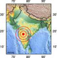
1993 Latur earthquake map.png 179 × 182; 24 KB
-
1997Jabalpur.png 214 × 193; 32 KB
-
1999Chamoli.png 179 × 159; 19 KB
-
2001 Gujarat earthquake.jpg 606 × 463; 46 KB
-
2021-04-28 Dhekiajuli, India M6 earthquake intensity map (USGS).jpg 612 × 684; 166 KB
-
2021-04-28 Dhekiajuli, India M6 earthquake shakemap (USGS).jpg 787 × 998; 396 KB
-
EQs 1900-2016 himalaya tsum.png 994 × 645; 1.14 MB
-
Kachchh Area.png 1,749 × 1,590; 3.44 MB
-
M 4.6 - Rajasthan, India.jpg 612 × 718; 112 KB
-
Main india night Jan 06-21-28 01.gif 368 × 229; 104 KB
-
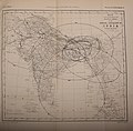
Oldham 1899 Map 1 memoirsofgeologi29geol 0547.jpg 3,863 × 2,902; 3.73 MB
-
Oldham 1899 Map 2 memoirsofgeologi29geol 0551.jpg 2,643 × 2,077; 1.88 MB
-
Oldham 1899 Map 3 memoirsofgeologi29geol 0555.jpg 3,430 × 3,366; 3.03 MB
-
Oldham 1899 Plate 42 memoirsofgeologi29geol 0541.jpg 3,040 × 4,530; 1.73 MB
-
Terremoto India, 18 de septiembre, 2011.jpg 612 × 684; 263 KB


