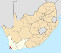
Category:Maps of districts of the Western Cape
Jump to navigation
Jump to search
Media in category "Maps of districts of the Western Cape"
The following 17 files are in this category, out of 17 total.
-
Map of South Africa with Cape Town highlighted (2016).svg 809 × 709; 716 KB
-
Map of the Western Cape with Cape Town highlighted (2016).svg 849 × 676; 478 KB
-
Map of South Africa with Cape Winelands highlighted (2016).svg 809 × 709; 719 KB
-
Map of the Western Cape with Cape Winelands highlighted (2016).svg 849 × 676; 477 KB
-
Map of South Africa with Central Karoo highlighted (2016).svg 809 × 709; 720 KB
-
Map of the Western Cape with Central Karoo highlighted (2016).svg 849 × 676; 475 KB
-
Map of South Africa with Garden Route highlighted (2016).svg 809 × 709; 722 KB
-
Map of the Eden district with local municipalities labelled (2011).svg 1,133 × 512; 227 KB
-
Map of the Western Cape with Garden Route highlighted (2016).svg 849 × 676; 490 KB
-
Map of South Africa with Overberg highlighted (2016).svg 809 × 709; 721 KB
-
Map of the Western Cape with Overberg highlighted (2016).svg 849 × 676; 488 KB
-
Map of South Africa with West Coast highlighted (2016).svg 809 × 709; 731 KB
-
Map of the West Coast district with local municipalities labelled (2011).svg 541 × 1,068; 256 KB
-
Map of the Western Cape with West Coast highlighted (2016).svg 849 × 676; 509 KB


