Category:Maps of districts of Lesotho
Jump to navigation
Jump to search
Countries of Africa: Algeria · Botswana · Republic of the Congo · Ethiopia · Lesotho · Madagascar · Rwanda · South Africa · South Sudan · Sudan · Uganda · Zambia · Zimbabwe
Limited recognition: Somaliland
Limited recognition: Somaliland
Subcategories
This category has only the following subcategory.
Media in category "Maps of districts of Lesotho"
The following 17 files are in this category, out of 17 total.
-
 District of lesotho AR.PNG 1,023 × 1,000; 164 KB
-
 Districts of Lesotho.png 268 × 263; 31 KB
-
 Lesotho Base Map.png 1,108 × 694; 232 KB
-
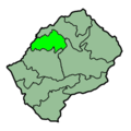 Lesotho Districts Berea 250px.png 250 × 251; 22 KB
-
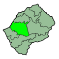
 Lesotho Districts Butha-Buthe 250px.png 250 × 251; 22 KB
-
 Lesotho Districts Leribe 250px.png 250 × 251; 22 KB
-
 Lesotho Districts Mafeteng 250px.png 250 × 251; 22 KB
-
 Lesotho Districts Maseru 250px.png 250 × 251; 22 KB
-
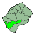 Lesotho Districts Mohales Hoek 250px.png 250 × 251; 22 KB
-
 Lesotho Districts Mokhotlong 250px.png 250 × 251; 22 KB
-
 Lesotho Districts Qachas Nek 250px.png 250 × 251; 22 KB
-
 Lesotho Districts Quthing 250px.png 250 × 251; 22 KB
-
 Lesotho Districts Thaba-Tseka 250px.png 250 × 251; 22 KB
-
 Lesotho subdivisions fr.svg 573 × 492; 402 KB
-
 Lesotho subdivisions MH.png 573 × 492; 83 KB
-
 Lesotho.geohive mk.gif 620 × 540; 13 KB
-
 Lesotho.geohive.gif 620 × 540; 10 KB


