Category:Maps of districts of Germany
Jump to navigation
Jump to search

Use the appropriate category for maps showing all or a large part of district of Germany. See subcategories for smaller areas:
| If the map shows | Category to use |
|---|---|
| district of Germany on a recently created map | Category:Maps of districts of Germany or its subcategories |
| district of Germany on a map created more than 70 years ago | Category:Old maps of districts of Germany or its subcategories |
| the history of district of Germany on a recently created map | Category:Maps of the history of districts of Germany or its subcategories |
| the history of district of Germany on a map created more than 70 years ago | Category:Old maps of the history of districts of Germany or its subcategories |
Subcategories
This category has the following 27 subcategories, out of 27 total.
*
A
C
- Maps of Cammin (district) (8 F)
E
- Maps of Elbing (district) (5 F)
F
H
M
N
R
S
- Maps of Salzlandkreis (5 F)
W
Media in category "Maps of districts of Germany"
The following 56 files are in this category, out of 56 total.
-
 Kreis Anklam 1794.jpg 1,357 × 859; 688 KB
-
 Pommern Kr Anklam.png 326 × 277; 61 KB
-
 Pommern Kr Belgard.png 384 × 338; 84 KB
-
 Kreis Belgard-Polzin 1794.jpg 1,051 × 899; 531 KB
-
 Hessen Kr Biedenkopf ed.png 287 × 538; 419 KB
-
 Übersichtskarte des Kreises Brilon.JPG 1,970 × 2,423; 875 KB
-
 Kreis Bromberg 1772.jpg 899 × 895; 332 KB
-
 Pommern Kr Bublitz.png 334 × 252; 56 KB
-
 Pommern Kr Bütow.png 233 × 227; 37 KB
-
 Kreis Danziger Höhe 1878.jpg 297 × 323; 80 KB
-
 Kreis Danziger Niederung 1878.jpg 564 × 352; 149 KB
-
 Landkreis Danzig bis 1887.jpg 762 × 643; 314 KB
-
 Kreis Deutsch Krone bis 1806.jpg 1,002 × 1,251; 488 KB
-
 Kreis Deutsch Krone bis 1945.jpg 755 × 564; 325 KB
-
 Kreis Dirschau 1887.jpg 350 × 407; 118 KB
-
 Pommern Kr Dramburg.png 302 × 370; 75 KB
-
 Landkreis Erkelenz 1820.jpg 896 × 949; 539 KB
-
 Kreis Flatow 1890.jpg 567 × 496; 116 KB
-
 Pommern Kr Franzburg-Barth.png 285 × 358; 66 KB
-
 Historische Landkarte der Grafschaft Schaumburg hessischen Anteils (1840).jpg 1,800 × 2,331; 1.01 MB
-
 Kreis Greifenhagen 1794.jpg 745 × 808; 361 KB
-
 Pommern Kr Greifenhagen.png 318 × 326; 70 KB
-
 Schlesien Kr Groß Strehlitz.png 396 × 227; 60 KB
-
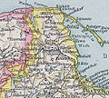
 Kr Heydekrug.png 1,027 × 849; 1.96 MB
-
 Kreis Karthaus 1818.jpg 654 × 578; 261 KB
-
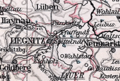
 Karte Landkreis Liegnitz.png 1,153 × 733; 137 KB
-
 Schlesien Kr Liegnitz.png 281 × 189; 37 KB
-
 Nassau Kr Sankt Goarshausen.png 387 × 346; 74 KB
-
 Kreis Marienburg 1772.jpg 752 × 840; 285 KB
-
 Kreis Marienburg 1818.jpg 442 × 421; 155 KB
-
 Kreis Marienwerder 1890.jpg 494 × 449; 183 KB
-
 Kreis Marienwerder bis 1818.jpg 942 × 748; 309 KB
-
 Kr Memel.png 658 × 1,270; 1.64 MB
-
 Schlesien Kr Militsch.png 285 × 161; 32 KB
-
 Kreis Neustadt in Westpreußen 1878.jpg 589 × 532; 229 KB
-
 Kreis Neustettin 1794.jpg 1,121 × 967; 544 KB
-
 Pommern Kr Neustettin.png 381 × 337; 87 KB
-
 Elchniederungsbahn.png 1,047 × 878; 1.95 MB
-
 Kr Niederung.png 1,047 × 871; 1.98 MB
-
 Nassau Oberwesterwaldkreis.png 265 × 300; 48 KB
-
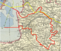
 Kreis Schloßberg (Pillkallen).png 1,701 × 1,261; 3.64 MB
-
 Kreis Putzig 1878.jpg 527 × 345; 61 KB
-
 Landkarte Kreis Pyritz.jpg 4,125 × 3,394; 1.67 MB
-
 Kreis Randow 1794.jpg 1,026 × 1,064; 670 KB
-
 Pommern Kr Regenwalde.png 303 × 317; 63 KB
-
 Nassau Rheingaukreis.png 387 × 183; 40 KB
-
 Kreis Rosenberg 1890.jpg 515 × 396; 174 KB
-
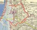
 Landkreis Samland.png 414 × 329; 61 KB
-
 Schlesien Kr Strehlen.png 195 × 195; 26 KB
-
 Kreis Stuhm 1890.jpg 383 × 423; 140 KB
-
 Kreis Tost-Gleiwitz Karte.jpg 592 × 976; 131 KB
-
 Nassau Unterlahnkreis.png 440 × 241; 62 KB
-
 Nassau Untertaunuskreis.png 435 × 244; 64 KB
-
 Nassau Unterwesterwaldkreis.png 263 × 325; 50 KB
-
 Kreis Waldenburg.jpg 3,617 × 4,000; 11.42 MB
-
 Schlesien Kr Waldenburg.png 313 × 198; 45 KB


.jpg)


.png)


