
Category:Maps of districts of Balochistan
Subcategories
This category has the following 32 subcategories, out of 32 total.
A
- Awaran District maps (3 F)
B
- Barkhan District maps (3 F)
C
- Chagai District maps (3 F)
D
- Dera Bugti District maps (3 F)
G
- Gwadar District maps (4 F)
H
- Harnai District maps (2 F)
J
- Jafarabad District maps (3 F)
- Jhal Magsi District maps (3 F)
K
- Maps of Kachhi District (3 F)
- Kalat District maps (3 F)
- Kharan District maps (3 F)
- Khuzdar District maps (3 F)
- Kohlu District maps (3 F)
L
- Lasbela District maps (3 F)
- Loralai District maps (3 F)
M
- Mastung District maps (3 F)
- Musakhel District maps (3 F)
N
- Nasirabad District maps (3 F)
- Nushki District maps (2 F)
P
- Panjgur District maps (3 F)
- Pishin District maps (5 F)
Q
- Quetta District maps (3 F)
S
- Sherani District maps (3 F)
- Sibi District maps (3 F)
- Sohbatpur District maps (1 F)
W
- Washuk District maps (2 F)
Z
- Zhob District maps (3 F)
- Ziarat District maps (3 F)
Media in category "Maps of districts of Balochistan"
The following 15 files are in this category, out of 15 total.
-
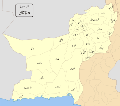
 BalochistanMap.png 720 × 540; 13 KB
-
 Balochistan new map.JPG 649 × 582; 47 KB
-
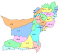
 Balochistan administrative1.PNG 791 × 697; 40 KB
-
 Balochistan districts Pakistan.PNG 1,213 × 704; 112 KB
-
 Baluchistan Disricts.PNG 699 × 639; 33 KB
-
 Balochistan Dist Names2.svg 4,166 × 3,691; 628 KB
-
 Balochistan Districts.svg 1,000 × 887; 74 KB
-
 Balochistan districts 1973.svg 512 × 393; 284 KB
-
 Districts of Balochistan, Pakistan with district names-2022 by Vijay Kumar Rajput.jpg 3,960 × 3,000; 1.21 MB
-
 Districts of Balochistan, Pakistan with district names.png 3,960 × 3,000; 1.91 MB
-
 Districts of Balochistan, Pakistan.png 3,960 × 3,000; 1.51 MB
-
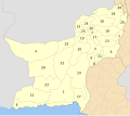
 Pakistan - Balochistan districts numbered 2017.svg 512 × 393; 333 KB
-
 Pakistan - Balochistan districts numbered 2021.svg 957 × 735; 338 KB
-
 Pakistan - Balochistan districts with names 2017.svg 512 × 393; 346 KB
-
 Pakistan - Balochistan districts with names 2021.svg 957 × 735; 339 KB


