Category:Maps of districts of Balıkesir Province
Jump to navigation
Jump to search
Media in category "Maps of districts of Balıkesir Province"
The following 29 files are in this category, out of 29 total.
-
Balıkesir (tr).svg 740 × 691; 49 KB
-
Balikesir districts.png 1,056 × 816; 38 KB
-
Balıkesir ili, 1923 yılında.png 590 × 508; 60 KB
-
Districts of Balıkesir.png 7,138 × 6,037; 2.37 MB
-
Districts of Balıkesir.svg 590 × 508; 661 KB
-
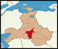
Altıeylül District Location in Balıkesir Province.png 4,283 × 3,622; 705 KB
-
Balıkesir location Altıeylül.png 590 × 508; 89 KB
-
Balıkesir location Ayvalık.svg 590 × 508; 690 KB
-
Balıkesir location Balya.svg 590 × 508; 690 KB
-
Balıkesir location Bandırma.svg 590 × 508; 690 KB
-
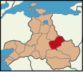
Balıkesir location Bigadiç.svg 590 × 508; 690 KB
-
Balıkesir location Burhaniye.svg 590 × 508; 690 KB
-
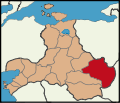
Balıkesir location Dursunbey.svg 590 × 508; 690 KB
-
Balıkesir location Edremit.svg 590 × 508; 690 KB
-
Balıkesir location Erdek.svg 590 × 508; 690 KB
-
Balıkesir location Gömeç.svg 590 × 508; 718 KB
-
Balıkesir location Gönen.svg 590 × 508; 690 KB
-
Balıkesir location Havran.svg 590 × 508; 690 KB
-
Balıkesir location Karesi.png 590 × 508; 88 KB
-
Balıkesir location Kepsut.svg 590 × 508; 690 KB
-
Balıkesir location Manyas.svg 590 × 508; 690 KB
-
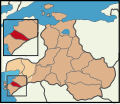
Balıkesir location Marmara.svg 590 × 508; 690 KB
-
Balıkesir location Merkez.svg 590 × 508; 690 KB
-
Balıkesir location Savaştepe.svg 590 × 508; 690 KB
-
Balıkesir location Sındırgı.svg 590 × 508; 690 KB
-
Balıkesir location Susurluk.svg 590 × 508; 690 KB
-
Balıkesir location İvrindi.svg 590 × 508; 690 KB
-
Bigadic-Köyler-Haritasi.jpg 9,197 × 4,739; 5.84 MB
-
Karesi District Location in Balıkesir Province.png 4,283 × 3,622; 706 KB


