Category:Maps of disasters in the United States
Jump to navigation
Jump to search
Subcategories
This category has the following 5 subcategories, out of 5 total.
D
E
F
V
Media in category "Maps of disasters in the United States"
The following 14 files are in this category, out of 14 total.
-
1900 Galveston hurricane path.png 2,700 × 1,861; 3.6 MB
-
1900 Galveston hurricane track.png 2,700 × 1,861; 3 MB
-
1985-05-31 tornado outbreak map.PNG 705 × 520; 141 KB
-
California Disaster Areas, 1964.svg 512 × 857; 741 KB
-
Largest Oil Spills Affecting U.S. Waters Since 1969.jpg 2,000 × 1,199; 356 KB
-
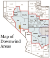
Map of Downwind Areas by the United States Department of Justice.png 200 × 228; 53 KB
-
May31CLEtracks.gif 780 × 730; 68 KB
-
Oil1969extent.jpg 3,040 × 2,288; 804 KB
-
Rolling Fork Highlighted Damage (Buildings).png 1,419 × 1,519; 1.02 MB
-
SPC Mesoscale Discussion 329 Twitter Graphic— Rolling Fork EF4 tornado.jpg 1,024 × 768; 188 KB
-
SPC Mesoscale Discussion 329 — Rolling Fork EF4 tornado.png 1,024 × 768; 282 KB
-
Tornado Outbreak 1985-05-31 map US.png 1,078 × 724; 103 KB
-
Tornado Outbreak 1985-05-31 map.png 2,190 × 2,033; 201 KB
-
Valdeztrack.png 471 × 366; 33 KB


