Category:Maps of counties of the United States
Jump to navigation
Jump to search
Countries of the Americas: United States of America
Subcategories
This category has the following 7 subcategories, out of 7 total.
*
M
Media in category "Maps of counties of the United States"
The following 69 files are in this category, out of 69 total.
-
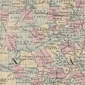
1880 County Map of the State of Texas detail.jpg 2,348 × 2,340; 1.5 MB
-
2010 US rice production.svg 844 × 634; 1.91 MB
-
2024 Republican priamry results by county.svg 990 × 627; 1.21 MB
-
Alcohol control in the United States.svg 512 × 324; 751 KB
-
All Washington Counties.svg 986 × 624; 1.44 MB
-
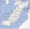
ARC counties as of 2023.svg 747 × 704; 1.61 MB
-
Blank USA map with counties.svg 1,102 × 678; 12.13 MB
-
Corn belt.svg 844 × 647; 2.71 MB
-
Counties by population.png 1,513 × 983; 153 KB
-
Counties of the USA.png 1,463 × 990; 177 KB
-
Counties of United States.png 1,513 × 983; 56 KB
-
Counties with In-N-Out.svg 990 × 627; 1.33 MB
-
COVID-19 outbreak USA stay-at-home order county map.svg 1,306 × 828; 1.48 MB
-
COVID-19 pandemic in the United States by county.svg 512 × 325; 1.53 MB
-
Democratic presidential primaries results by county margin, 2000.svg 1,304 × 828; 1.35 MB
-
Democratic presidential primaries results by county margin, 2004.svg 1,304 × 828; 2.43 MB
-
Democratic presidential primaries results by county, 2000.svg 1,304 × 828; 1.35 MB
-
DesafioLocalidadesUSA.svg 555 × 352; 1.77 MB
-
Evolution of United States standard time zone boundaries.webm 29 s, 3,507 × 2,480; 4.58 MB
-
Intermountain West.svg 386 × 550; 1.69 MB
-
Jewish population in the USA in 2000.svg 1,684 × 1,190; 3.39 MB
-
Map Of New England Counties.svg 1,200 × 1,956; 59 KB
-
Map of Sanctuary Cities and Counties in the United States.svg 990 × 627; 1.36 MB
-
Map of US sodomy laws.svg 555 × 352; 2.16 MB
-
Map of USA with county outlines (black & white).png 1,513 × 983; 56 KB
-
Map of USA with county outlines.png 1,513 × 983; 581 KB
-
NWS Weather Forecast Offices.svg 512 × 321; 1.63 MB
-
Ocean Coast Line County’s.jpg 2,542 × 1,591; 1.64 MB
-
Ogallala changes 1980-1995.svg 761 × 1,002; 1.74 MB
-
Ogallala saturated thickness 1997-sattk97.svg 1,491 × 1,732; 5.64 MB
-
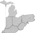
Ohio and adjacent States and counties with FIPS and names.svg 151 × 140; 264 KB
-
Physiographic Provinces 48 Conterminous US-v1.svg 1,000 × 600; 2.05 MB
-
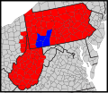
Presbytery of Redstone map.svg 159 × 137; 208 KB
-
Property taxes by county.webp 1,919 × 1,291; 553 KB
-
Sales tax by county.webp 2,808 × 1,771; 543 KB
-
Synod of the Trinity map - border.svg 159 × 137; 208 KB
-
Synod of the Trinity map.svg 130 × 130; 69 KB
-
U.S. counties population.JPG 1,513 × 983; 393 KB
-
U.S. Counties.png 4,200 × 3,105; 1.55 MB
-
United States county map with state borders, cb 500k.svg 542 × 334; 13.32 MB
-
United States presidential birthplaces.svg 990 × 627; 1.58 MB
-
US Conterminous 48 Physiographic Divisions v1.svg 820 × 570; 2.12 MB
-
US counties and cities with domestic partnership.svg 555 × 352; 1.33 MB
-
US counties and cities with gender identity protection.svg 555 × 352; 814 KB
-
US counties by median family income.png 1,513 × 983; 197 KB
-
US counties by median nonfamily income.png 1,513 × 983; 197 KB
-
US counties by per capita income.png 1,513 × 983; 197 KB
-
US counties by percentage BAs.png 1,513 × 983; 197 KB
-
US counties by population density.png 1,513 × 983; 199 KB
-
US counties by population growth.png 1,513 × 983; 206 KB
-
US counties common names (Night).png 1,513 × 983; 151 KB
-
Us counties from census bureau.pdf 8,397 × 6,297; 9.49 MB
-
US county map, blank, w territories.svg 990 × 627; 1.11 MB
-
US-McD.Terr.(1961).svg 26 × 22; 18 KB
-
USA counties FIPS text addressable.svg 555 × 352; 1.34 MB
-
Usa counties large.svg 990 × 627; 1.18 MB
-
USA Counties Map (with territories).jpg 1,800 × 1,113; 473 KB
-
USA counties white borders.svg 990 × 627; 1.46 MB
-
USA Counties with FIPS and names including territories.svg 555 × 352; 810 KB
-
USA Counties with FIPS and names.svg 555 × 352; 750 KB
-
USA Counties with names.svg 555 × 352; 1.45 MB
-
USA counties with territories.svg 1,306 × 828; 1.48 MB
-
USA Counties.svg 555 × 352; 1.11 MB
-
USA Dry Map.png 1,513 × 983; 71 KB
-
Washington Presbytery map.svg 159 × 137; 208 KB
-
Western United States counties, blank.svg 600 × 627; 620 KB
