Category:Maps of counties of South Khorasan Province
Jump to navigation
Jump to search
- Provinces of Iran
- Fars
- Kerman
- Mazandaran
- North Khorasan
- Razavi Khorasan
- Sistan and Baluchestan
- South Khorasan
- Tehran
Media in category "Maps of counties of South Khorasan Province"
The following 11 files are in this category, out of 11 total.
-
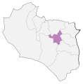
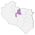
Birjand County Locator Map (2020).svg 1,244 × 1,263; 35 KB
-
Boshruye County Locator Map (2020).svg 1,244 × 1,263; 35 KB
-
Darmiyan County Locator Map (2020).svg 1,244 × 1,263; 35 KB
-
Ferdovs County Locator Map (2020).svg 1,244 × 1,263; 35 KB
-
Khusf County Locator Map (2020).svg 1,244 × 1,263; 35 KB
-
Nehbandan County Locator Map (2020).svg 1,244 × 1,263; 35 KB
-
Qaenat County Locator Map (2020).svg 1,244 × 1,263; 35 KB
-
Sarayan County Locator Map (2020).svg 1,244 × 1,263; 35 KB
-
Sarbishe County Locator Map (2020).svg 1,244 × 1,263; 35 KB
-
Tabas County Locator Map (2020).svg 1,244 × 1,263; 35 KB
-
ZirKuh County Locator Map (2020).svg 1,244 × 1,263; 35 KB


