Category:Maps of communes in Hautes-Alpes
Jump to navigation
Jump to search
Departments of Metropolitan France: Ain [01] · Aisne [02] · Allier [03] · Alpes-de-Haute-Provence [04] · Hautes-Alpes [05] · Alpes-Maritimes [06] · Ardèche [07] · Ardennes [08] · Ariège [09] · Aube [10] · Aude [11] · Aveyron [12] · Bouches-du-Rhône [13] · Calvados [14] · Cantal [15] · Charente [16] · Charente-Maritime [17] · Cher [18] · Corrèze [19] · Corse-du-Sud [2A]† · Haute-Corse [2B]† · Côte-d’Or [21] · Côtes-d'Armor [22] · Creuse [23] · Dordogne [24] · Doubs [25] · Drôme [26] · Eure [27] · Eure-et-Loir [28] · Finistère [29] · Gard [30] · Haute-Garonne [31] · Gers [32] · Gironde [33] · Hérault [34] · Ille-et-Vilaine [35] · Indre [36] · Indre-et-Loire [37] · Isère [38] · Jura [39] · Landes [40] · Loir-et-Cher [41] · Loire [42] · Haute-Loire [43] · Loire-Atlantique [44] · Loiret [45] · Lot [46] · Lot-et-Garonne [47] · Lozère [48] · Maine-et-Loire [49] · Manche [50] · Marne [51] · Haute-Marne [52] · Mayenne [53] · Meurthe-et-Moselle [54] · Meuse [55] · Morbihan [56] · Moselle [57] · Nièvre [58] · Nord [59] · Oise [60] · Orne [61] · Pas-de-Calais [62] · Puy-de-Dôme [63] · Pyrénées-Atlantiques [64] · Hautes-Pyrénées [65] · Pyrénées-Orientales [66] · Bas-Rhin [67] · Haut-Rhin [68] · departmental district of the Rhône [69] · Rhône [69D]‡ · Metropolis of Lyon [69M]‡ · Haute-Saône [70] · Saône-et-Loire [71] · Sarthe [72] · Savoie [73] · Haute-Savoie [74] · Paris [75] · Seine-Maritime [76] · Seine-et-Marne [77] · Yvelines [78] · Deux-Sèvres [79] · Somme [80] · Tarn [81] · Tarn-et-Garonne [82] · Var [83] · Vaucluse [84] · Vendée [85] · Vienne [86] · Haute-Vienne [87] · Vosges [88] · Yonne [89] · Territoire de Belfort [90] · Essonne [91] · Hauts-de-Seine [92] · Seine-Saint-Denis [93] · Val-de-Marne [94] · Val-d'Oise [95]
Overseas departments and regions: Guadeloupe [971] · Martinique [972] · French Guiana [973] · Réunion [974] · Mayotte [976]
Sui generis territories: New Caledonia [988]
Overseas departments and regions: Guadeloupe [971] · Martinique [972] · French Guiana [973] · Réunion [974] · Mayotte [976]
Sui generis territories: New Caledonia [988]

Subcategories
This category has the following 172 subcategories, out of 172 total.
*
2
A
- Maps of Aiguilles (1 F)
- Maps of Ancelle (2 F)
- Maps of Arvieux (4 F)
- Maps of Aspres-lès-Corps (3 F)
- Maps of Aspres-sur-Buëch (1 F)
- Maps of Aubessagne (2 F)
B
- Maps of Baratier (1 F)
- Maps of Barcillonnette (1 F)
- Maps of Barret-sur-Méouge (1 F)
- Maps of La Bâtie-Montsaléon (1 F)
- Maps of La Bâtie-Neuve (1 F)
- Maps of La Bâtie-Vieille (1 F)
- Maps of La Beaume (1 F)
- Maps of Le Bersac (1 F)
- Maps of Bréziers (1 F)
- Maps of Briançon (6 F)
- Maps of Buissard (1 F)
C
- Maps of Ceillac (1 F)
- Maps of Chabestan (1 F)
- Maps of Chabottes (3 F)
- Maps of Champcella (1 F)
- Maps of Champoléon (6 F)
- Maps of Chanousse (1 F)
- Maps of Châteauneuf-d'Oze (7 F)
- Maps of Crévoux (1 F)
- Maps of Crots (3 F)
D
- Maps of Dévoluy (commune) (1 F)
E
- Maps of Embrun (6 F)
- Maps of Éourres (1 F)
- Maps of Espinasses (1 F)
- Maps of Étoile-Saint-Cyrice (1 F)
- Maps of Eygliers (1 F)
F
- Maps of La Fare-en-Champsaur (1 F)
- Maps of La Faurie (1 F)
- Maps of Forest-Saint-Julien (1 F)
- Maps of Freissinières (4 F)
- Maps of La Freissinouse (1 F)
- Maps of Furmeyer (1 F)
G
- Maps of Garde-Colombe (1 F)
- Maps of Le Glaizil (1 F)
- Maps of La Grave (6 F)
- Maps of Guillestre (5 F)
H
- Maps of La Haute-Beaume (1 F)
J
- Maps of Jarjayes (4 F)
L
- Maps of Laragne-Montéglin (5 F)
- Maps of Lardier-et-Valença (1 F)
- Maps of Laye (1 F)
- Maps of Lazer (Hautes-Alpes) (6 F)
- Maps of Lettret (1 F)
M
- Maps of Manteyer (1 F)
- Maps of Méreuil (1 F)
- Maps of Molines-en-Queyras (3 F)
- Maps of Monêtier-Allemont (1 F)
- Maps of Montbrand (1 F)
- Maps of Montgardin (1 F)
- Maps of Montgenèvre (1 F)
- Maps of Moydans (1 F)
N
- Maps of Neffes (3 F)
- Maps of Névache (3 F)
- Maps of Nossage-et-Bénévent (1 F)
O
- Maps of Orcières (2 F)
- Maps of Orpierre (1 F)
- Maps of Les Orres (1 F)
- Maps of Oze (Hautes-Alpes) (empty)
P
- Maps of Pelleautier (1 F)
- Maps of La Piarre (1 F)
- Maps of Le Poët (3 F)
- Maps of Puy-Saint-André (4 F)
- Maps of Puy-Saint-Eusèbe (1 F)
- Maps of Puy-Saint-Pierre (1 F)
- Maps of Puy-Saint-Vincent (1 F)
- Maps of Puy-Sanières (1 F)
R
- Maps of Rabou (1 F)
- Maps of Réallon (1 F)
- Maps of Remollon (1 F)
- Maps of Réotier (1 F)
- Maps of Ribeyret (1 F)
- Maps of Risoul (3 F)
- Maps of La Roche-de-Rame (1 F)
- Maps of La Roche-des-Arnauds (1 F)
- Maps of Rosans (1 F)
S
- Maps of Saint-André-d'Embrun (1 F)
- Maps of Saint-Auban-d'Oze (1 F)
- Maps of Saint-Chaffrey (1 F)
- Maps of Saint-Pierre-Avez (1 F)
- Maps of Saint-Véran (3 F)
- Maps of Le Saix (1 F)
- Maps of Saléon (1 F)
- Maps of Salérans (1 F)
- Maps of La Salle-les-Alpes (1 F)
- Maps of La Saulce (1 F)
- Maps of Savines-le-Lac (4 F)
- Maps of Savournon (1 F)
- Maps of Sigottier (1 F)
T
- Maps of Tallard (1 F)
- Maps of Théus (1 F)
- Maps of Trescléoux (1 F)
U
- Maps of Upaix (1 F)
V
- Maps of Val Buëch-Méouge (1 F)
- Maps of Val-des-Prés (1 F)
- Maps of Valdoule (1 F)
- Maps of Vallouise-Pelvoux (5 F)
- Maps of Valserres (6 F)
- Maps of Vars (Hautes-Alpes) (6 F)
- Maps of Ventavon (1 F)
- Maps of Veynes (1 F)
- Maps of Les Vigneaux (1 F)
- Maps of Villar-d'Arêne (5 F)
- Maps of Villar-Loubière (1 F)
Media in category "Maps of communes in Hautes-Alpes"
This category contains only the following file.
-
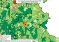 05 HAUTES-ALPES carte grille communale densite INSEE.png 3,507 × 2,480; 2.13 MB
