Category:Maps of colonial South America
Jump to navigation
Jump to search
Subcategories
This category has the following 3 subcategories, out of 3 total.
Media in category "Maps of colonial South America"
The following 48 files are in this category, out of 48 total.
-
Non-Native American Nations Control over South America 1700 and on.gif 800 × 1,100; 262 KB
-
America 1794.png 988 × 1,270; 297 KB
-
Amerika gyarmatosítása (1750).png 463 × 599; 77 KB
-
Audencias of Viceroyalty of Peru.PNG 766 × 1,003; 168 KB
-
Brazil and la Plata.png 1,038 × 1,599; 548 KB
-
Brésil relais des Etats-Unis en Amérique du Sud.png 1,023 × 768; 37 KB
-
Capitanía General de Chile, 1775, mapa satelital.svg 1,710 × 2,684; 8.84 MB
-
Capitanía General de Chile, 1775.svg 1,710 × 2,684; 4.53 MB
-
Capitanía General de Chile, 1776.svg 1,710 × 2,684; 4.77 MB
-
Capitanía General de Chile, 1810 (Uti possidetis iuris).svg 1,710 × 2,684; 5.8 MB
-
Capitulacion1529.png 455 × 681; 305 KB
-
Captaincy General of Chile, 1775.svg 1,710 × 2,684; 4.5 MB
-
Cedulas1534-1539.png 455 × 680; 288 KB
-
Cimarrones und Reiterkulturen in Südamerika.png 403 × 671; 147 KB
-
Colonias europea en América siglo XVI-XVIII.png 536 × 618; 11 KB
-
Colonization of the Americas 1750 id.PNG 470 × 623; 17 KB
-
Colonization of the Americas 1750.PNG 470 × 623; 18 KB
-
Colonizationoftheamericas-ar.png 463 × 599; 68 KB
-
Colonizationoftheamericas-blank.png 470 × 608; 9 KB
-
Colonizationoftheamericas.png 470 × 608; 19 KB
-
Crown of-Castile.PNG 452 × 886; 73 KB
-
Dutch in the Americas.png 726 × 726; 40 KB
-
Establecimientos del Imperio español en la Patagonia atlántica.svg 570 × 958; 4.31 MB
-
Gobernaciones españolas en América del Sur (1529).svg 505 × 682; 3.31 MB
-
Gobernaciones españolas en América del Sur (1534-1539).svg 673 × 909; 3.77 MB
-
Gobernación de la Terra Australis (1539-1555), España.svg 744 × 1,219; 1.67 MB
-
Governorate of Terra Australis (1539-1555), Spain.svg 744 × 1,219; 1.67 MB
-
Imperios Español y Portugués 1790.svg 2,655 × 3,000; 7.7 MB
-
Kolonisierung Amerikas.png 470 × 608; 23 KB
-
Mapa de la América española (1800).png 1,365 × 1,761; 175 KB
-
Non-Native American Nations Control over South America 1700 and on.ogv 44 s, 800 × 1,100; 369 KB
-
Nuevo Mapa Del Virreinato Del Río De La Plata 2.svg 553 × 838; 867 KB
-
Nuevo Mapa Del Virreinato Del Río De La Plata.svg 415 × 628; 1 MB
-
Real Audiencia de Charcas (1785).svg 1,417 × 1,063; 4.77 MB
-
Real Audiencia de Charcas (1810).svg 1,417 × 1,063; 4.7 MB
-
SpanishSouthAmerica.png 1,038 × 1,599; 500 KB
-
Spanish colonization of the Americas.png 470 × 608; 15 KB
-
Spanish Empire - 1824.jpg 800 × 370; 25 KB
-
Spanish Empire-Americas.png 450 × 628; 16 KB
-
SpanishAmerica1764.png 808 × 1,236; 54 KB
-
Südamerika1650.png 498 × 589; 35 KB
-
Südamerika1754.png 497 × 588; 27 KB
-
Theviceroyaltyofperu.png 1,350 × 625; 101 KB
-
Viceroyalties in Spanish America after 1776.png 562 × 767; 117 KB
-
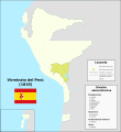
Virreinato del Perú (1810).svg 1,949 × 2,126; 7.45 MB


