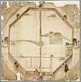
Category:Maps of city walls in the Netherlands
Jump to navigation
Jump to search
Nederlands: Kaarten en plattegronden van stadsmuren en vestingmuren in Nederland.
Media in category "Maps of city walls in the Netherlands"
The following 12 files are in this category, out of 12 total.
-
09 203 stadsmuur Brielle Langestraat 14e-eeuws 1997-1998.jpg 2,753 × 1,834; 1,002 KB
-
1530, Kaart met stadsmuren voor Den Haag, plan variant.jpg 9,912 × 6,944; 14.38 MB
-
1530, Kaart met stadsmuren voor Den Haag.jpg 9,936 × 10,104; 19.44 MB
-
1615, Vestingkaart van Den Haag.jpg 6,000 × 6,179; 4.66 MB


