Category:Maps of cities served by flights from given airport
Jump to navigation
Jump to search
Subcategories
This category has the following 9 subcategories, out of 9 total.
Media in category "Maps of cities served by flights from given airport"
The following 176 files are in this category, out of 176 total.
-
100329 Zielgebietskarte S2010.png 2,335 × 1,208; 216 KB
-
Aeropuerto el dorado RUTAS2.jpg 540 × 540; 137 KB
-
Air routes from AKL.PNG 2,390 × 976; 136 KB
-
Air routes from ATH.PNG 1,208 × 593; 74 KB
-
Air routes from BKK.PNG 1,752 × 628; 181 KB
-
Air routes from CAN.png 1,233 × 642; 125 KB
-
Air routes from CDG.PNG 2,436 × 715; 270 KB
-
Air Routes from CGK.PNG 940 × 781; 132 KB
-
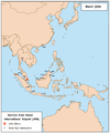
Air Routes from DPS2.PNG 759 × 549; 39 KB
-
Air routes from FRA.PNG 2,528 × 709; 230 KB
-
Air routes from GRQ.PNG 1,335 × 1,114; 546 KB
-
Air routes from GRU.PNG 1,357 × 628; 87 KB
-
Air routes from GVA.PNG 1,198 × 845; 112 KB
-
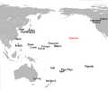
Air routes from HNL.PNG 1,165 × 978; 57 KB
-
Air Routes from HVA.PNG 878 × 628; 47 KB
-
Air routes from JFK.PNG 1,752 × 628; 153 KB
-
Air Routes from JNB.PNG 1,482 × 628; 89 KB
-
Air Routes from JNB2.PNG 1,482 × 628; 86 KB
-
Air Routes from KEF2.PNG 962 × 600; 119 KB
-
Air routes from LAX.PNG 1,875 × 628; 137 KB
-
Air routes from LHR.PNG 2,096 × 628; 218 KB
-
Air routes from LUD.PNG 1,357 × 628; 53 KB
-
Air routes from MEX.PNG 1,949 × 628; 105 KB
-
Air routes from MFN.PNG 945 × 550; 39 KB
-
Air routes from MNL.PNG 2,156 × 980; 131 KB
-
Air routes from MNL.png 1,073 × 625; 69 KB
-
Air routes from NAI.PNG 1,405 × 529; 102 KB
-
Air Routes from NRT.PNG 1,450 × 628; 103 KB
-
Air routes from PEK.PNG 2,222 × 652; 214 KB
-
Air routes from PER.PNG 780 × 530; 41 KB
-
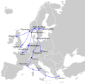
Air Routes from PRG.PNG 967 × 518; 101 KB
-
Air routes from SGN.PNG 1,273 × 628; 63 KB
-
Air Routes from TEH2.PNG 1,532 × 643; 102 KB
-
Air routes from TLL.PNG 616 × 580; 93 KB
-
Air routes from TLV.PNG 1,752 × 628; 148 KB
-
Air routes from VVO.PNG 560 × 572; 22 KB
-
Air routes from YVR.PNG 1,546 × 628; 107 KB
-
AKL destinations.svg 1,052 × 744; 145 KB
-
AKL Longhaul Destinations.png 720 × 360; 32 KB
-
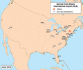
Albanyairportmap.png 1,000 × 842; 290 KB
-
ALICANTE Flygplats-Sverige.PNG 958 × 798; 97 KB
-
Almaty International Airport.JPG 1,425 × 625; 101 KB
-
AZO Airline Route Map-2010 Nov.png 759 × 495; 108 KB
-
BDL FLIGHTS as of 24 Nov 2012.jpg 720 × 360; 69 KB
-
BDL FLIGHTS as of 30 July 2012.jpg 661 × 352; 214 KB
-
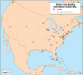
Bdlairportmap.png 1,000 × 901; 348 KB
-
BEL-ATUAL02.png 540 × 540; 117 KB
-
BGIROUTES1.jpg 720 × 360; 51 KB
-
BGIROUTES3.jpg 540 × 429; 67 KB
-
BGO international map.svg 454 × 450; 480 KB
-
BHX destinations map.png 1,799 × 819; 107 KB
-
BKI airport map.PNG 1,471 × 2,002; 504 KB
-
BLR intl destinations, 11-2013.png 716 × 358; 41 KB
-
Bogotaairportmap.png 1,000 × 1,000; 326 KB
-
BOSdomestic&canada.png 1,221 × 778; 143 KB
-
BOSeurope.png 1,524 × 1,053; 48 KB
-
BVA destinations, 11-2013.png 524 × 358; 51 KB
-
Bwiairportmap.png 1,000 × 1,003; 431 KB
-
Cairnsairportmap.png 1,000 × 1,001; 333 KB
-
Calgaryairportmap.png 1,000 × 1,000; 456 KB
-
CCS-NONSTOP-EN.png 1,420 × 790; 1.14 MB
-
CCS-NONSTOP-ES.png 1,420 × 790; 1.13 MB
-
Cebu Airport Route Map.svg 720 × 720; 2.41 MB
-
Cebuairportmap.png 2,363 × 2,360; 420 KB
-
CRW flight map.svg 1,859 × 968; 732 KB
-
DCA flight map.svg 1,323 × 874; 375 KB
-
Dcaairportmap.png 1,000 × 1,004; 382 KB
-
Dfw-asia.gif 720 × 360; 18 KB
-
DNL domestic route map.svg 501 × 526; 95 KB
-
DNL international route map.svg 454 × 450; 325 KB
-
Domestic Destinations from JFK.png 918 × 510; 58 KB
-
Domestic Destinations JFK June 2013.jpg 1,133 × 640; 71 KB
-
Domestic Destinations JFK.png 918 × 510; 73 KB
-
Dtwairportmap.png 2,000 × 2,000; 1.23 MB
-
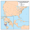
Dullesairportmap.png 1,000 × 1,000; 494 KB
-
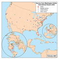
Dullesairportmap2.png 1,000 × 1,000; 465 KB
-
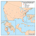
Dullesairportmap3.png 1,000 × 1,000; 542 KB
-
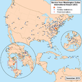
Dullesairportmap4.png 1,000 × 1,000; 557 KB
-
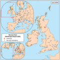
Edinburghairportmap.png 1,000 × 1,000; 576 KB
-
FBU international map.svg 454 × 450; 472 KB
-
Fina Regional OR TAMBO.svg 1,052 × 744; 95 KB
-
Flights from Durban International Airport, with IATA codes.svg 600 × 400; 84 KB
-
Flights from Durban International Airport.svg 600 × 400; 235 KB
-
Flights serving Sydney2.PNG 1,466 × 628; 62 KB
-
Fllairportmap.png 1,000 × 1,003; 535 KB
-
Glasgowairportmap.png 998 × 1,000; 572 KB
-
HNL routes.png 716 × 358; 46 KB
-
Iahairportmap.png 1,000 × 1,047; 579 KB
-
Iloilo International Airport air routes.png 784 × 900; 130 KB
-
International Destinations of Melbourne.svg 3,085 × 1,538; 1.28 MB
-
International flights from Cape Town International Airport.svg 600 × 400; 1.81 MB
-
JHB routes (final).PNG 1,455 × 1,750; 469 KB
-
JNB destinations, 11-2013.png 716 × 358; 55 KB
-
Joburg long Haul.png 1,154 × 500; 171 KB
-
KCH airport map.PNG 1,477 × 2,004; 509 KB
-
KCID Route Map April 2008.png 800 × 495; 101 KB
-
Keflavikairportmap.png 1,000 × 1,000; 487 KB
-
KSU rutekart utenriks.png 999 × 536; 177 KB
-
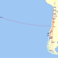
LAN Airline Route Map-2010 Dec.png 759 × 495; 110 KB
-
LAN Airline Route Map-2010 Jan.png 759 × 495; 102 KB
-
LAN Airline Route Map-2011 Apr.png 759 × 495; 112 KB
-
LAN Airline Route Map-2011 Dec.png 770 × 650; 180 KB
-
LAN Airline Route Map-2013 Feb-updated 2012 Aug.png 770 × 650; 186 KB
-
LAN Airline Route Map-2013 Feb.png 770 × 650; 182 KB
-
LAN Route Map 085.jpg 1,005 × 703; 91 KB
-
LAN Route Map 085B 2009-Mar.jpg 1,005 × 703; 81 KB
-
LAN Route Map 2007-Jan-22.jpg 565 × 357; 59 KB
-
LAN Route Map 2007-Jan.png 800 × 495; 25 KB
-
LAN Route Map 2008-May.jpg 600 × 369; 41 KB
-
Latest Domestic Flights from johannesburg International Airport.svg 600 × 400; 147 KB
-
LAX international destinations (2024).png 2,754 × 1,398; 465 KB
-
Linhas austral.jpg 238 × 157; 28 KB
-
London ca airportmap-2009-12-10.png 1,000 × 1,000; 208 KB
-
London ca airportmap.png 1,000 × 1,004; 299 KB
-
Long Haul Flights johannesburgxxx.png 2,893 × 1,419; 450 KB
-
Main routes from Katowice Airport in H1 2023.png 3,543 × 2,480; 1.65 MB
-
Manilaairportmap.png 2,368 × 2,368; 573 KB
-
Map of Penang International Airport destinations.png 2,765 × 1,601; 654 KB
-
MASwings5.PNG 1,943 × 1,025; 134 KB
-
Miamiairportmap.png 997 × 1,000; 536 KB
-
MLI Route Map 085.jpg 1,005 × 703; 211 KB
-
Mochis.png 2,636 × 1,594; 124 KB
-
Montrealairportmap.png 1,000 × 1,005; 579 KB
-
MSY flight map.svg 1,859 × 968; 752 KB
-
Network intern Trapani (Estate 2011).gif 540 × 540; 78 KB
-
Network Internazionale Aeroporto di Genova.jpg 1,288 × 791; 363 KB
-
Network naz Trapani (Estate 2011).gif 540 × 540; 81 KB
-
Non-stop Routes from MLI 2012.png 799 × 494; 99 KB
-
Non-stop Routes from MLI.png 1,005 × 703; 539 KB
-
Norfolkairportmap.png 1,000 × 1,003; 336 KB
-
Ohareairportmap.png 1,000 × 1,006; 581 KB
-
Ovdaairportmap.png 1,000 × 1,000; 339 KB
-
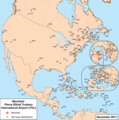
Panamaairportmap.png 1,000 × 1,048; 366 KB
-
Pbiairportmap.png 1,004 × 1,000; 295 KB
-
PEN airport route.PNG 1,300 × 1,630; 422 KB
-
Philyairportmap.png 1,001 × 1,000; 472 KB
-
PHNL Longhaul Destinations.gif 540 × 540; 19 KB
-
Phxairportmap.png 1,000 × 1,003; 435 KB
-
PIA Route Map.PNG 800 × 495; 101 KB
-
Pittsburghairportmap.png 1,000 × 1,000; 311 KB
-
Prestwickairportmap.png 1,000 × 910; 316 KB
-
Pwm airport.svg 1,020 × 1,000; 343 KB
-
RAP flight map.svg 1,859 × 968; 730 KB
-
Regional flights from Cape Town International Airport.svg 600 × 400; 336 KB
-
Regional Flights from johannesburg.svg 504 × 299; 33 KB
-
ROA nonstop passenger flights as of July 30 2012.jpg 457 × 294; 96 KB
-
Rutekart KSU innenriks revidert.png 546 × 595; 93 KB
-
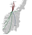
RYG destinations.svg 645 × 690; 579 KB
-
Sanjuanairportmap.png 1,001 × 1,000; 365 KB
-
Sanjuanairportmap.svg 765 × 765; 5.73 MB
-
Santiago vuelos domesticos.gif 540 × 540; 11 KB
-
SDF flight map.svg 1,859 × 968; 736 KB
-
SJU European Routes.gif 720 × 360; 20 KB
-
SJU International Caribbean Region Routes.gif 540 × 540; 16 KB
-
SJU Lesser Antilles-Local Routes.gif 720 × 360; 13 KB
-
SKG-destinations.svg 1,471 × 950; 870 KB
-
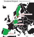
Smaland airport regualr destinations.pdf 1,752 × 1,881; 81 KB
-
Smaland airport regualr destinations.svg 394 × 426; 115 KB
-
SVG international map.svg 454 × 450; 472 KB
-
SXM intl destinations, 11-2013.png 717 × 356; 42 KB
-
SXM regional destinations, 11-2013.png 537 × 349; 16 KB
-
SYD Intl Dest.svg 2,722 × 1,251; 1.43 MB
-
Tambo long Haul.svg 1,427 × 628; 34 KB
-
TPA destinations north america.png 1,401 × 992; 244 KB
-
TRD destinations map.svg 645 × 690; 490 KB
-
TRF destination map.svg 454 × 450; 475 KB
-
TVC Airline Route Map-2010 Jun.png 759 × 495; 106 KB
-
TVC Airline Route Map-2012 Jun.png 759 × 495; 107 KB
-
TVC Airline Route Map-2013 Jul.png 759 × 495; 108 KB
-
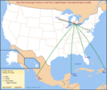
Westchester County Airport Destinations.gif 540 × 540; 51 KB
-
Ykfairportmap.png 1,000 × 1,003; 330 KB
-
ZGGG Intl Dest.svg 3,069 × 1,538; 1.28 MB


