Category:Maps of cities in the United States
Jump to navigation
Jump to search
Countries of the Americas: Argentina · Brazil · Canada · Chile · Colombia · Costa Rica · Cuba · El Salvador · Haiti · Mexico · Peru · United States of America · Uruguay · Venezuela
Subcategories
This category has the following 11 subcategories, out of 11 total.
2
D
L
O
R
Media in category "Maps of cities in the United States"
The following 15 files are in this category, out of 15 total.
-
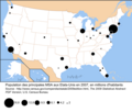
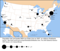
Carte des villes américaines.svg 908 × 593; 494 KB
-
Carte villes américaine.png 714 × 496; 11 KB
-
Carte villes USA1.png 1,500 × 684; 245 KB
-
Carte villes USA2.png 1,500 × 1,254; 397 KB
-
Largest US cities Map-Persian.jpg 1,513 × 983; 123 KB
-
Map of American urban areas by size.svg 904 × 588; 394 KB
-
Map of Sanctuary Cities and Counties in the United States.svg 990 × 627; 1.36 MB
-
Map-USA-Cities01.png 1,551 × 1,080; 280 KB
-
Map-USA-Cities01.svg 515 × 359; 356 KB
-
Mapa ciudades USA.svg 908 × 593; 422 KB
-
MSA USA 2007 blank.png 2,500 × 2,116; 634 KB
-
MSA USA 2007.png 2,500 × 2,116; 762 KB
-
Springfields.png 449 × 251; 31 KB
-
US state capitals.png 795 × 517; 38 KB
-
USA-Urban-Areas.svg 3,257 × 1,981; 14.5 MB


