Category:Maps of canals in the United States
Jump to navigation
Jump to search
Subcategories
This category has the following 8 subcategories, out of 8 total.
Media in category "Maps of canals in the United States"
The following 66 files are in this category, out of 66 total.
-
1795 Schuykill Navigation company Map for PA canals.jpg 2,047 × 1,494; 2.03 MB
-
1827 Morris Canal.jpg 3,000 × 1,538; 576 KB
-
20020525 18 Morris Canal map (8282037451).jpg 1,799 × 1,128; 475 KB
-
Albemarle and Chesapeake Canal.png 2,000 × 2,000; 337 KB
-
All american canal map.png 300 × 300; 70 KB
-
American railway transportation (1908) (14572819860).jpg 2,848 × 1,816; 1,015 KB
-
AssawomanCanal.png 2,000 × 2,000; 178 KB
-
Canals USA 1825.png 960 × 930; 195 KB
-
Canaveral Barge Canal.png 2,000 × 2,000; 255 KB
-
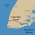
CapeMayCanal.png 2,000 × 2,000; 188 KB
-
Cincinnati and Whitewater Canal.jpg 1,242 × 1,330; 316 KB
-
Cumberland&OxfordCanal.png 1,414 × 2,016; 207 KB
-
CVP Map.png 2,123 × 2,538; 6.94 MB
-
CVPFacilities.jpg 358 × 599; 113 KB
-
D&H-Canal.svg 1,100 × 936; 761 KB
-
Delaware and Hudson Canal Map.png 1,100 × 936; 672 KB
-
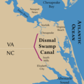
DismalSwampCanal.png 2,000 × 2,000; 324 KB
-
GreatLoop.png 2,000 × 3,000; 529 KB
-
Gulf Intracoastal Waterway.png 1,500 × 1,000; 147 KB
-
Hampshire and Hampden Canal map, 1831 - Anthony Finley.jpg 3,644 × 2,847; 5.98 MB
-
Haulover Canal.png 2,000 × 2,000; 254 KB
-
Historic highways of America (Volume 13) - II.png 6,377 × 1,823; 1.5 MB
-
Hocking Canal map.jpg 1,242 × 1,330; 336 KB
-
Illinois and Michigan Canal and the proposed Hennepin Canal.png 1,594 × 2,341; 7.15 MB
-
Illinois and Michigan Canal parkways system (NBY 1324).jpg 3,600 × 2,237; 1.03 MB
-
Illinois-michigan-canal.png 626 × 531; 358 KB
-
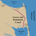
LewesAndRehobothCanal.png 2,000 × 2,000; 219 KB
-
Line of the Morris Canal, New Jersey, 1827.jpg 6,325 × 2,746; 4.89 MB
-
Little Butte Creek Diversion Map.png 1,525 × 1,505; 984 KB
-
Main Line of Public Works.png 870 × 560; 109 KB
-
Map of Main Line of Public Work in Pennsylvania.png 1,807 × 986; 850 KB
-
Map of Virginia, Maryland and Delaware WDL9595.png 1,379 × 1,024; 2.38 MB
-
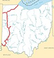
Miami and Erie Canal system map captioned.jpg 1,242 × 1,330; 341 KB
-
Miami and Erie Canal system map.jpg 1,242 × 1,330; 317 KB
-
Miami and Erie Canal.jpg 1,242 × 1,330; 324 KB
-
Miami Canal.png 2,000 × 2,000; 173 KB
-
Pennsylvania and Ohio Canal map.jpg 1,242 × 1,330; 319 KB
-
Pennsylvania canals.png 759 × 414; 133 KB
-
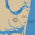
PointPlesantCanal.png 2,000 × 2,000; 205 KB
-
Sacramento Deep Water Ship Channel.png 533 × 800; 1.16 MB
-
Sandy and Beaver Canal map.jpg 1,242 × 1,330; 319 KB
-
Sidney Feeder Canal.jpg 1,242 × 1,330; 316 KB
-
Sturgeon Bay Ship Canal.jpg 1,000 × 1,213; 362 KB
-
Tamiami Canal.png 2,000 × 2,000; 165 KB
-
Tenn-tom.gif 276 × 543; 8 KB
-
Two Canals sign.jpg 1,600 × 1,200; 452 KB
-
USACE Divide Cut map large.png 1,902 × 1,242; 560 KB
-
USACE Tenn-Tom project map.png 380 × 474; 34 KB
-
Wabash and Erie Canal.jpg 1,242 × 1,330; 318 KB
-
Walhonding Canal map.jpg 1,242 × 1,330; 316 KB
-
Walhondingcanalmap.png 500 × 500; 127 KB
-
Warren Canal.jpg 1,242 × 1,330; 316 KB
-
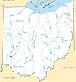
Warren County Canal.jpg 896 × 653; 220 KB


