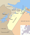
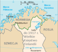
Category:Maps of borders of Finland
Jump to navigation
Jump to search
Subcategories
This category has only the following subcategory.
M
- Maps of Moscow Peace Treaty (23 F)
Media in category "Maps of borders of Finland"
The following 49 files are in this category, out of 49 total.
-
1323 Treaty of Orekhov.svg 366 × 641; 26 KB
-
1595 Treaty of Tyavzino.svg 366 × 641; 29 KB
-
1617 Treaty of Stolbovo.svg 366 × 641; 24 KB
-
1721 Treaty of Uusikaupunki.svg 390 × 641; 25 KB
-
1743 Treaty of Turku.svg 390 × 641; 22 KB
-
1775 area shift.svg 390 × 641; 23 KB
-
1809 Treaty of Hamina.svg 390 × 641; 24 KB
-
1812 area shift.svg 409 × 641; 27 KB
-
1830 area shift.svg 409 × 641; 27 KB
-
1833 area shift.svg 409 × 641; 26 KB
-
1842 area shift.svg 409 × 641; 26 KB
-
1864 area shift.svg 409 × 641; 26 KB
-
1920 Treaty of Tartu.svg 409 × 641; 32 KB
-
1940 Treaty of Moscow.svg 409 × 641; 34 KB
-
1944 Interim Treaty of Moscow.svg 366 × 641; 28 KB
-
1947 area sale.svg 366 × 641; 28 KB
-
Area of Finland from 1947.svg 366 × 641; 25 KB
-
Border changes in Finland 1323.jpg 350 × 494; 26 KB
-
Border changes in Finland 1595.jpg 350 × 494; 29 KB
-
Border changes in Finland 1617.jpg 350 × 494; 31 KB
-
Border changes in Finland 1721.jpg 350 × 494; 29 KB
-
Border changes in Finland 1743.jpg 350 × 494; 29 KB
-
Border changes in Finland 1809.jpg 350 × 494; 31 KB
-
Border changes in Finland 1812.jpg 350 × 494; 31 KB
-
Border changes in Finland 1833.jpg 350 × 494; 31 KB
-
Border changes in Finland 1864.jpg 350 × 494; 30 KB
-
Border changes in Finland 1920.jpg 350 × 494; 34 KB
-
Border changes in Finland 1944.jpg 350 × 494; 34 KB
-
Border changes in Finland 1947.jpg 350 × 494; 34 KB
-
Border changes in Finland.gif 175 × 247; 179 KB
-
EEZ Finland.png 7,521 × 5,375; 2.97 MB
-
Finland 1595.jpg 351 × 474; 25 KB
-
Finland 1918 plain.png 800 × 995; 17 KB
-
Finland Russian&Sweden Border.png 5,020 × 6,300; 43.98 MB
-
Finland se toegewings.png 619 × 800; 38 KB
-
Finland-Norway border map.png 514 × 290; 93 KB
-
Finland-Russia border.jpg 609 × 995; 200 KB
-
Finland-Soviet Union, Oktober-November 1939.PNG 620 × 801; 82 KB
-
Finnish areas ceded in 1944 RUS.png 619 × 800; 96 KB
-
Finnland 1323-1743.png 500 × 640; 214 KB
-
Karta Meänmaa Original.jpg 1,402 × 1,965; 659 KB
-
Koiluoto-en.svg 646 × 338; 169 KB
-
Koiluoto-fr.svg 646 × 338; 161 KB
-
Norway Borders.png 503 × 618; 488 KB
-
Petsamo.png 800 × 945; 30 KB
-
PL-Russenorsk.png 328 × 294; 31 KB
-
Plans for Finland in Barbarossa.png 817 × 1,108; 323 KB
-
UG EZY wikimeetup in Vyborg 2021-01-02 - IMG 9129.jpg 3,024 × 4,032; 404 KB
-
Карта острова Койлуото.svg 449 × 271; 34 KB


