Category:Maps of beltways in the United States
Jump to navigation
Jump to search
Countries of North America: United States of America‡
‡: partly located in North America
‡: partly located in North America
Media in category "Maps of beltways in the United States"
The following 51 files are in this category, out of 51 total.
-
Allegheny County Belt System.png 2,566 × 2,415; 2.9 MB
-
Arizona State Route 101 map.png 2,205 × 1,286; 90 KB
-
Arizona State Route 101 map.svg 725 × 430; 168 KB
-
Arizona State Route 202 map.png 2,205 × 1,286; 72 KB
-
Arizona State Route 202 map.svg 1,001 × 586; 260 KB
-
Baltimore, Maryland 1955 Yellow Book.jpg 800 × 703; 185 KB
-
Belt Parkway Map.svg 1,027 × 609; 1.02 MB
-
Capital Beltway Harrisburg map.png 2,282 × 1,354; 238 KB
-
Capital Beltway Map Color.png 562 × 487; 66 KB
-
Capital Beltway Map Color.svg 564 × 489; 279 KB
-
Capital Beltway Map.png 562 × 487; 121 KB
-
Charlotte Route 4.svg 1,152 × 684; 425 KB
-
Cincinnati, Ohio 1955 Yellow Book.jpg 800 × 791; 184 KB
-
Colorado State Highway 470 Map.svg 1,028 × 609; 1.25 MB
-
Columbus, Ohio 1955 Yellow Book.jpg 800 × 1,073; 187 KB
-
DC freeway map.svg 7,107 × 5,930; 253 KB
-
District of Columbia 1955 Yellow Book.jpg 800 × 971; 246 KB
-
Dothan.svg 1,848 × 1,864; 188 KB
-
E-470 Map.svg 1,028 × 609; 1.46 MB
-
Fort Worth, Texas 1955 Yellow Book.jpg 800 × 859; 209 KB
-
Georgia state route 10 loop map.png 429 × 276; 51 KB
-
Georgia state route 120 loop map.png 946 × 966; 214 KB
-
GreensboroHighways.gif 1,090 × 553; 248 KB
-
Houston, Texas 1955 Yellow Book.jpg 497 × 451; 222 KB
-
I-240 (TN) map.svg 1,180 × 688; 232 KB
-
I-240 Tennessee.png 1,180 × 688; 91 KB
-
I-264 (KY) map.svg 1,180 × 688; 345 KB
-
I-270 (OH) map.svg 1,475 × 860; 415 KB
-
I-275 (IN-KY-OH) map B.svg 1,475 × 860; 925 KB
-
I-275 (IN-KY-OH) map.svg 1,475 × 860; 368 KB
-
I-285 (GA) map.svg 1,180 × 688; 329 KB
-
I-410 map.svg 1,180 × 688; 361 KB
-
I-435 (KS-MO) map.svg 1,475 × 860; 469 KB
-
I-485 (NC) map.svg 1,475 × 860; 978 KB
-
I-485 NC map.svg 1,026 × 608; 1.21 MB
-
I-695 in MD map.png 922 × 579; 51 KB
-
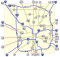
Indianapolis.svg 1,624 × 1,548; 723 KB
-
Inner Loop Rochester 2014 map.svg 1,450 × 860; 1.52 MB
-
Inner Loop Rochester map.svg 1,450 × 860; 1.72 MB
-
Interstate 410 map.png 2,320 × 1,376; 91 KB
-
Interstate 610 map (Texas).svg 1,180 × 688; 309 KB
-
Interstate 820 map (Texas).svg 1,180 × 688; 245 KB
-
Kansas City, Missouri 1955 Yellow Book.jpg 800 × 1,042; 239 KB
-
Louisville, Kentucky 1955 Yellow Book.jpg 800 × 991; 248 KB
-
Memphis, Tennessee 1955 Yellow Book.jpg 800 × 768; 153 KB
-
Michigan 114 map.png 2,255 × 1,333; 180 KB
-
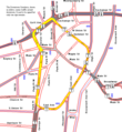
Pawtucket Circulator map.png 665 × 722; 25 KB
-
San Antonio, Texas 1955 Yellow Book.jpg 800 × 824; 227 KB
-
Tennessee SR 840 Map.png 749 × 600; 305 KB
-
Texas Beltway 8 map.svg 1,088 × 645; 862 KB
-
Texas Loop 12 map.svg 1,088 × 645; 742 KB


