Category:Maps of battles of World War II
Jump to navigation
Jump to search
Subcategories
This category has the following 6 subcategories, out of 6 total.
E
M
Media in category "Maps of battles of World War II"
The following 69 files are in this category, out of 69 total.
-
Bitwa o Bolonie 1945.PNG 2,441 × 2,588; 745 KB
-
Advance to Lone Tree Hill.jpg 2,400 × 1,182; 259 KB
-
AFHQ Structure, 1943.png 4,704 × 1,578; 2.14 MB
-
Alamein battle map heb.jpg 880 × 1,200; 461 KB
-
Alpine Line 10 June 1940-es.svg 1,083 × 1,290; 4.83 MB
-
Alpine Line 10 June 1940-IT.svg 1,083 × 1,290; 4.19 MB
-
Alpine Line 10 June 1940.png 1,089 × 1,284; 1.5 MB
-
Alpine Line 10 June 1940.svg 1,083 × 1,290; 4.22 MB
-
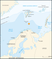
Barents 1942-it.svg 969 × 1,094; 158 KB
-
Barents 1942.svg 964 × 1,088; 130 KB
-
Bataille Kasserine.jpg 2,000 × 1,828; 953 KB
-
Battle for Carentan - Map.jpg 799 × 608; 181 KB
-
Battle for Carentan - Map.svg 188 × 144; 983 KB
-
Battle of Menton (1940)-IT.png 1,140 × 1,106; 395 KB
-
Battle of Menton (1940).svg 1,140 × 1,106; 259 KB
-
Battle of Médenine.jpg 1,200 × 1,574; 353 KB
-
Battle of Piva Forks final phase map 21-25 Nov 43.jpg 1,000 × 666; 122 KB
-
Battle of Piva Forks Nov19.jpg 1,300 × 757; 481 KB
-
Battle of Piva Forks second day map 20 Nov 43.jpg 1,000 × 654; 344 KB
-
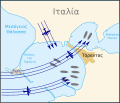
Battle of Taranto map-el.svg 712 × 611; 49 KB
-
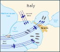
Battle of Taranto map-en.svg 712 × 611; 50 KB
-
Battle of Taranto map-es.svg 712 × 611; 47 KB
-
Battle of Taranto map-fr.svg 712 × 611; 49 KB
-
Battle of Taranto map-it.svg 712 × 611; 49 KB
-
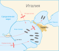
Battle of Taranto map-ru.svg 889 × 761; 100 KB
-
Battle Philippine sea map-en.svg 732 × 671; 161 KB
-
Battle Philippine sea map-es.svg 732 × 671; 135 KB
-
Battle Philippine sea map-fr.svg 732 × 671; 158 KB
-
Battle Philippine sea map-he.svg 732 × 671; 142 KB
-
Battle Philippine sea map-hu.svg 732 × 671; 150 KB
-
Bitwa bolonia 1945.png 2,431 × 2,288; 2.01 MB
-
Bitwa o Nowogrod.png 1,760 × 900; 1.21 MB
-
Convoy PQ-17 map 1942 (noms des navires)-fr.svg 970 × 1,095; 186 KB
-
Convoy PQ-17 map 1942-fr.svg 970 × 1,095; 239 KB
-
Coral Sea battle.svg 868 × 717; 497 KB
-
CrusaderPlan.jpg 1,794 × 1,216; 565 KB
-
Fifth army1.jpg 1,216 × 648; 197 KB
-
Gdmaptargul.gif 437 × 289; 12 KB
-
Gela 11 lug 43.jpg 3,384 × 2,650; 1.41 MB
-
Guam Landing beaches.jpg 950 × 714; 131 KB
-
Hong Kong 18-25 December 1941.jpg 1,200 × 811; 243 KB
-
Hong Kong 18-25 December 1941.png 1,855 × 1,293; 2.04 MB
-
Italian offensive Bourg Saint-Maurice-1940-IT.png 606 × 493; 156 KB
-
Italian offensive Bourg Saint-Maurice-1940-IT.svg 606 × 493; 196 KB
-
Italian offensive Bourg Saint-Maurice-1940.svg 606 × 493; 92 KB
-
Italian offensive Mont Cenis-1940-IT.png 606 × 492; 210 KB
-
Italian offensive Mont Cenis-1940.svg 606 × 492; 332 KB
-
Italian offensive, Bourg Saint-Maurice.png 858 × 511; 58 KB
-
Italian offensive, Mont Cenis.png 851 × 514; 70 KB
-
La battaglia di Balmafol.jpg 1,623 × 2,584; 1.07 MB
-
Map of battle of Kleisoura Pass, April 1941.png 2,180 × 1,634; 1.92 MB
-
Map of German Counterattack on Carentan.jpg 595 × 386; 188 KB
-
Map of the Battle of Tinian (1944)-es.svg 486 × 577; 92 KB
-
Map of the Battle of Tinian (1944)-hu.svg 486 × 577; 492 KB
-
Map of the Battle of Tinian (1944).svg 486 × 577; 493 KB
-
Map of the East Prussian offensive.png 550 × 390; 653 KB
-
Map of the first phase of Operation Sportpalast.jpg 800 × 1,230; 248 KB
-
Map of the second phase of Operation Sportpalast.jpg 800 × 1,238; 241 KB
-
Mappa Caposaldo Bir Hacheim.jpg 1,930 × 1,325; 360 KB
-
MarethMap1943 en.png 800 × 572; 176 KB
-
MarethMap1943.png 1,170 × 836; 236 KB
-
Meuse Situation generale 14 mai 40.svg 744 × 1,052; 176 KB
-
PivaForks Phase1.jpg 750 × 485; 46 KB
-
Second Battle of Odon EN.svg 1,476 × 768; 1.89 MB
-
TORNADO Task Force, Night 30-31 May 1944.jpg 2,400 × 743; 153 KB
-
Treasury Islands assault.jpg 1,900 × 1,240; 843 KB
-
Карта Восточно-Прусской операции.jpg 1,353 × 2,058; 901 KB


